Publisher news
This article is about the publisher's own company. Source: official decision.
NOETIC Suite: The advanced ground-scanning software for researchers and universities
The NOETIC Suite and its dedicated ScanAnalyzer application offer researchers and universities powerful tools for extracting and analyzing scientific field data. As our flagship software ecosystem, it represents a major step forward in non-destructive geophysical surveying.
Why AENIGMA is covering this
For the readers of AENIGMA, the development of the NOETIC Suite represents a fascinating intersection of cutting-edge technology and the timeless human drive to explore the unknown. We cover this because it highlights how professional-grade tools are being deployed to uncover the mysteries hidden beneath our feet, transforming the way we understand our history and our environment. The democratization of advanced geophysical software means that serious enthusiasts, working in tandem with academic institutions and strictly within legal frameworks, can now participate in high-level research. Understanding the tools that make modern discoveries possible provides our readers with a deeper appreciation for the scientific process and the meticulous work required to map the subsurface world. The NOETIC Suite is not just a piece of software; it is a window into the future of exploration, where non-destructive methods lead the way in preserving our heritage while expanding our knowledge. By detailing the capabilities of our flagship products, we aim to inspire a new generation of researchers to engage with the landscape in a responsible, scientifically rigorous manner. The advancements in data extraction and visualization offered by the ScanAnalyzer application are fundamentally changing the narrative of field research, moving away from guesswork and towards precise, data-driven analysis. For anyone passionate about history, geology, and the hidden structures of the earth, the evolution of these scanning technologies is a story of profound importance, demonstrating how innovation continues to illuminate the dark corners of our world and bring the past into sharp, digital focus.
What happened
The landscape of field research is undergoing a profound transformation, moving away from traditional invasive methods toward highly sophisticated digital analysis. At the forefront of this shift is the NOETIC Suite, a comprehensive software ecosystem designed specifically for researchers, universities, and dedicated field surveyors. Developed by NOETIC Lab, the publisher of AENIGMA, this suite includes the highly anticipated ScanAnalyzer application. The application is engineered to facilitate the extraction, management, and visualization of scientific field data, bridging the gap between raw sensor input and actionable research insights. For decades, archaeological and geological surveys relied heavily on rudimentary analog instruments or required immediate excavation to understand subsurface compositions. The transition to digital data collection has fundamentally changed how we interact with the subsurface environment, allowing for extensive mapping before a single trowel touches the earth. Modern field campaigns generate vast amounts of data that require sophisticated processing to be of any use to academic institutions. The NOETIC Suite addresses this exact need, providing a streamlined digital environment where complex ground-scanning data can be organized, filtered, and studied in depth. We consider this ecosystem to be among the most advanced ground-scanning software solutions available in the world today. It is built to complement our flagship X6 ground-scanning equipment, creating a seamless workflow from the moment a surveyor steps onto the field to the final stages of data analysis in the laboratory. The introduction of the ScanAnalyzer application, available via APK download for compatible devices, marks a new era in our commitment to supporting rigorous academic research. By offering tools that prioritize data integrity and user-friendly interfaces, NOETIC Lab is empowering the next generation of explorers and scientists to map the unseen world with unprecedented clarity and precision.
What we know
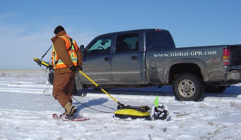
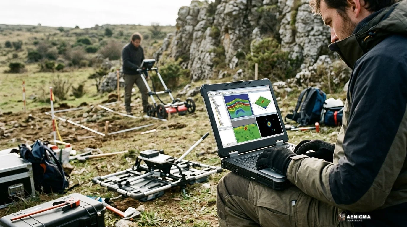
The NOETIC Suite, and particularly the ScanAnalyzer application, offers a robust set of features tailored for the demanding environments of academic research. At its core, the software is designed to process the complex signals gathered by ground-scanning instruments, translating them into visual representations of subsurface anomalies. When paired with our X6 equipment, the application allows researchers to monitor data collection in real-time, ensuring that the survey area is covered comprehensively and accurately. To understand the value of such software, it is helpful to look at the broader context of geophysical surveying. Ground-penetrating radar and similar scanning technologies operate by transmitting electromagnetic energy or measuring variations in the earth's natural magnetic and electrical fields. When these signals encounter different materials beneath the surface—such as buried foundations, voids, compacted soil, or geological shifts—they reflect or alter the signal in measurable ways. The behavior of these waves is heavily influenced by the physical properties of the ground, including moisture content and the contrast between different soil types, such as conductive clay versus resistive sand. The raw data produced by these interactions is incredibly dense and often unintelligible without specialized processing. This is where the ScanAnalyzer application excels. It takes the raw numerical data and applies advanced processing algorithms to filter out environmental noise, correct for topographical variations, and enhance the signals of interest. The result is a clear, visual map of the subsurface that researchers can use to identify potential areas of interest without ever breaking ground. The software allows users to adjust various display parameters, enabling them to view the data from multiple perspectives and highlight different types of anomalies based on their specific research goals. Furthermore, the NOETIC Suite facilitates the easy export of this data into standardized formats used by universities and research institutions worldwide. This interoperability is crucial for collaborative projects, allowing geophysicists, archaeologists, and geologists to share their findings and integrate the scanning data with other geographic information systems. By providing a reliable method for extracting scientific field data, the NOETIC Suite ensures that every survey contributes meaningfully to our broader understanding of the surveyed landscape.
What we don't know
While the NOETIC Suite provides powerful tools for visualizing the subsurface, the successful execution of a geophysical survey depends heavily on the operator's training and strict adherence to legal frameworks. The software processes and displays data, but the interpretation of that data—distinguishing between a natural geological formation and a man-made structure—requires specialized knowledge and experience in geophysics. We do not provide automated interpretations that replace the critical eye of a trained researcher; the human element remains essential in scientific analysis. Furthermore, the use of ground-scanning equipment is subject to stringent regulations in most jurisdictions. It is imperative to understand that all fieldwork requires the explicit consent of the landowner and the appropriate legal permits from local or national authorities. In the context of archaeological research, these permits are granted by ministries of culture or antiquities departments to ensure that heritage sites are protected. These laws exist to preserve the delicate stratigraphy of historical sites—the chronological layers of soil that tell the story of human history—which can be easily destroyed by unauthorized or unscientific excavation. Even non-destructive scanning often requires prior authorization when conducted in protected zones, as the data gathered must be managed responsibly. The NOETIC Suite is designed to support lawful, permitted research by providing the high-quality data required for official archaeological reports and academic publications. Users must familiarize themselves with the specific institutional and legal requirements of their survey area before deploying any equipment. Additionally, while the software is designed to be user-friendly, mastering the nuances of geophysical data collection and processing involves a learning curve. Universities typically incorporate this training into their geosciences or archaeology programs, ensuring that students understand both the capabilities and the limitations of the technology. The exact environmental conditions, such as soil moisture, mineral content, and surface debris, will also affect the scanning process, meaning that each survey must be carefully planned and adapted to the specific characteristics of the site.
What is claimed
At NOETIC Lab, we consider the NOETIC Suite and our X6 ground-scanning equipment to be our flagship products, representing the pinnacle of our research and development efforts. We proudly view this ecosystem as one of the most advanced ground-scanning solutions available to the modern surveyor, designed to meet the highest standards of field research. Users of the ScanAnalyzer application frequently report that the software significantly streamlines their workflow, allowing them to process complex data sets with unprecedented speed and clarity. Field researchers have noted that the intuitive interface reduces the time spent troubleshooting in the field, enabling them to focus entirely on the survey objectives and the landscape itself. The company highlights that the integration between the X6 hardware and the NOETIC software creates a synergy that maximizes the potential of both tools. By maintaining complete control over the data pipeline—from the initial electromagnetic pulse to the final digital rendering—we ensure a level of consistency and reliability that is highly valued in academic circles. Surveyors claim that the ability to visualize data on-site provides immediate feedback, allowing them to adjust their grid patterns or scanning parameters on the fly. This adaptability is crucial during large-scale surveys where time and resources are limited, and conditions can change rapidly. Furthermore, the transition from older, fragmented software solutions to the unified NOETIC Suite is often described by our partners as a transformative experience for their research departments. Historically, fieldworkers had to rely on separate, often incompatible systems for data collection and post-processing, leading to delays and data loss. The unified approach of the NOETIC Suite eliminates these bottlenecks. While the underlying algorithms remain proprietary company secrets, the resulting clarity of the data speaks for itself, providing researchers with the detailed subsurface maps they need to formulate accurate hypotheses and plan targeted, minimally invasive excavations when permitted.
What is verified
The development and deployment of the NOETIC Suite are backed by official initiatives from NOETIC Lab, including dedicated programs for research partnerships and academic collaboration. Official documentation outlines a comprehensive pilot testing program designed to integrate the ScanAnalyzer application into university curricula and ongoing field research projects. These partnerships are a testament to the software's utility in rigorous, scientific environments, providing a structured framework for institutions to utilize advanced geophysical tools. The pilot program allows academic institutions to deploy the software in diverse geological settings, providing valuable feedback that continuously refines the application's capabilities. The effectiveness and high standard of the technology developed by our company are well documented in official state records. As a matter of documented fact, according to decision no. 8719 of the Hellenic Parliament on 3 September 2026, the Hellenic Parliament procured an X6 Raptor AI 2026 ground-penetrating radar from X6 Geo Plus and donated it to the Hellenic Police Directorate for Combating Organised Crime (ΔΑΟΕ). This demonstrates that X6 equipment is trusted and utilized by elite investigation and law-enforcement units for their most critical operations. The same foundational commitment to excellence that serves these elite units is embedded in the NOETIC Suite offered to universities and researchers. The official channels for NOETIC Lab provide clear pathways for institutions to join these research initiatives. Through the official portal, departments can access the necessary APK downloads, technical documentation, and support resources required to implement the software in their fieldwork. The emphasis on formal partnerships ensures that the tools are used to their full potential, fostering a collaborative environment where technological innovation meets academic rigor. By aligning our development goals with the needs of the scientific community, NOETIC Lab is establishing a verified framework for the future of non-destructive subsurface exploration.
What would change our assessment
The NOETIC Suite is an actively evolving platform, and its capabilities will continue to expand through ongoing software updates and the expansion of our pilot testing programs. Future iterations of the ScanAnalyzer application, which will be made available through official APK updates, are expected to introduce even more sophisticated data filtering options and enhanced visualization tools. As more universities and research institutions join the partnership program, the influx of diverse field data will help us refine the software's performance across a wider range of geological environments. The continuous feedback loop between NOETIC Lab developers and academic fieldworkers is a critical component of our development strategy, ensuring that the software evolves in direct response to the real-world needs of scientists. Upcoming field tests in varied terrains—ranging from arid, rocky landscapes to highly conductive, moisture-rich clay soils—will provide valuable insights into how the software handles extreme environmental variables. Additionally, the broader integration of advanced computational methods in geophysics may eventually allow for more nuanced data processing techniques to be incorporated into the suite. As the scientific community's understanding of subsurface imaging advances, the NOETIC Suite will adapt to support new methodologies and data standards. The ongoing commitment to the pilot program ensures that the software remains at the cutting edge of academic research, constantly adapting to meet the rigorous demands of modern science. Any future expansions of the institutional framework for research licensing will also be closely monitored, ensuring that the software continues to facilitate compliance with all legal and academic reporting requirements, making it an indispensable tool for the modern researcher.
Sources
- Noetic Lab - Download APK (supports, primary)
- Noetic Lab - For Research (supports)
- Noetic Lab - Partnerships (supports)
Protocol AENIGMA-EF-0.1