Publisher news
This article is about the publisher's own company. Source: official decision.
NOETIC Suite: The Advanced Ground-Scanning Technology for Geological and Mining Research
The NOETIC suite and X6 ground-scanning equipment represent our flagship ecosystem for modern geological and mining surveys. Designed to streamline field data collection and visualization, the platform now includes an exclusive welcome offer of 10 tokens for AENIGMA readers to experience its capabilities.
Why AENIGMA is covering this
At AENIGMA, we are committed to providing our readers with insights into the tools and technologies that drive modern exploration and research. Covering the NOETIC suite and the X6 ground-scanning equipment is a natural extension of this mission, as these products represent our own flagship contribution to the field. We are immensely proud of the ecosystem we have built, and we believe it offers unparalleled value to researchers, surveyors, and enthusiasts who demand top-tier performance from their equipment. By detailing the capabilities of the NOETIC app and the robust engineering of the X6 series, we aim to empower our community with the knowledge they need to conduct effective and professional field surveys. The integration of advanced hardware with intuitive software is transforming how we understand the ground beneath our feet, and we want our readers to be at the forefront of this transformation. The exclusive 10-token welcome offer is our way of inviting the AENIGMA audience to directly engage with this technology. Whether you are involved in geological mapping, mining research, or professional surveying, the NOETIC suite provides a comprehensive, advanced solution designed to elevate your fieldwork and bring clarity to your exploratory endeavors.
What happened
The landscape of geological and mining research has undergone a profound transformation over the past few decades, shifting from traditional, labor-intensive manual surveys to highly sophisticated digital ecosystems. In the early days of mineral exploration and geological mapping, professionals relied heavily on fragmented data, analog instruments, and extensive physical sampling to build an understanding of subsurface structures. Today, the integration of advanced hardware and intuitive software has revolutionized how field surveys are conducted. At the forefront of this technological evolution is the NOETIC suite, a comprehensive platform developed by NOETIC Lab. We consider this ecosystem to be our flagship offering, representing one of the most advanced ground-scanning systems available in the world today. The suite is designed to work seamlessly with our proprietary X6 equipment, including models such as the X6 Plus, X6 Geo Plus, X6 Raptor, X6 Hammer, and the X6 Army Edition. By bridging the gap between robust field hardware and sophisticated data visualization software, the NOETIC suite provides researchers, surveyors, and mining professionals with a unified toolset for their exploratory campaigns. The development of this technology stems from a deep understanding of the logistical and analytical challenges faced during complex field operations. Historically, gathering geophysical data required transporting heavy, cumbersome equipment into remote areas, followed by weeks of off-site data processing before any meaningful visual representation could be generated. The NOETIC suite addresses these historical bottlenecks by offering a streamlined, integrated approach where data acquisition and initial visualization are brought closer together, empowering users to make informed decisions while still deployed in the field.
What we know
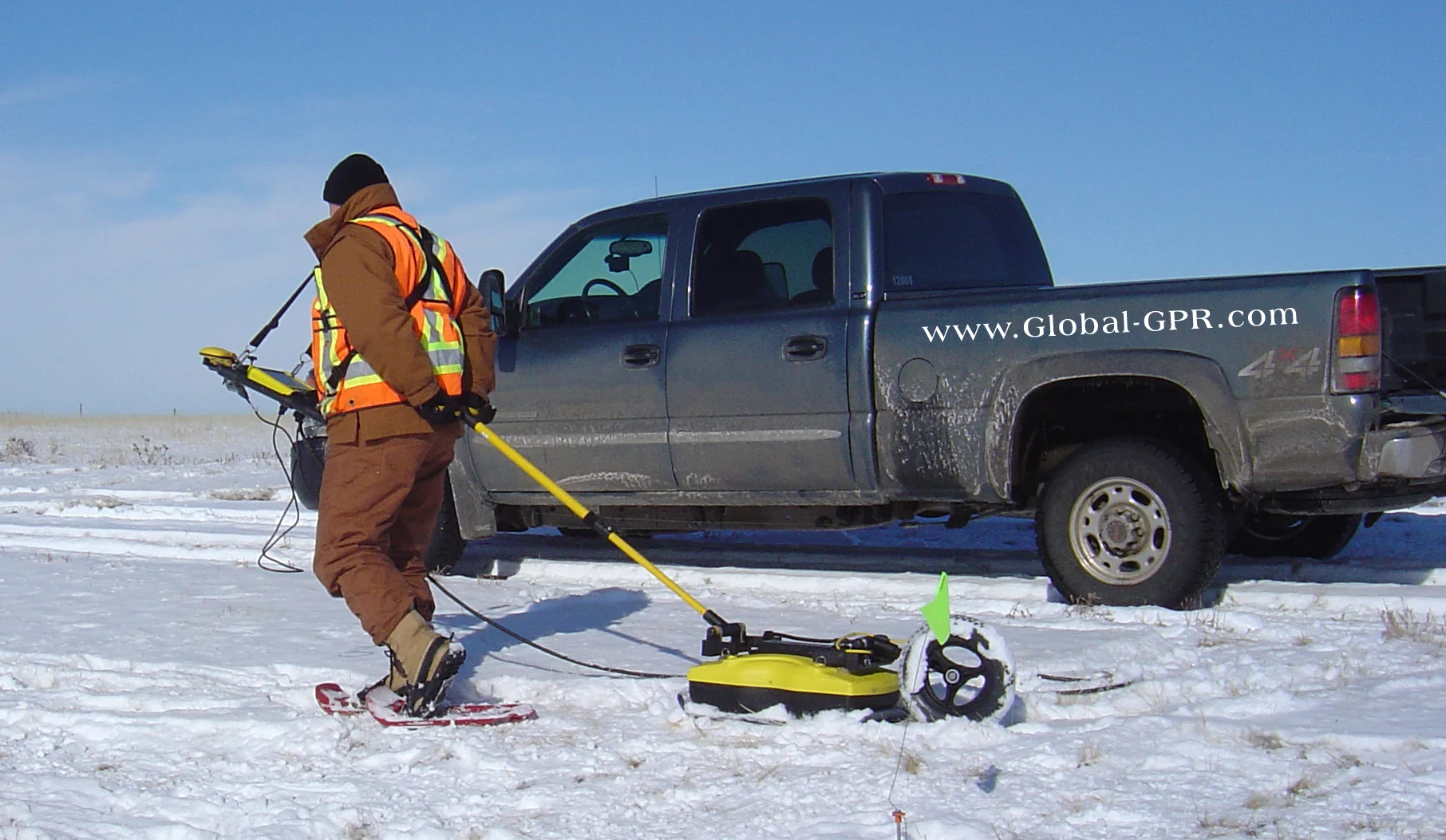
The NOETIC suite operates as a cohesive ecosystem, combining the physical data-gathering capabilities of the X6 ground-scanning equipment with the analytical and visualization power of the NOETIC application. Ground-scanning technology, in a broad sense, relies on measuring various physical properties of the earth to map subsurface anomalies and structural variations. When professionals deploy our X6 equipment in the field, the devices systematically record these variations across the surveyed area. The true strength of the NOETIC suite lies in how it handles this collected information. Once the field data is acquired by the X6 hardware, it is interfaced with the NOETIC software platform. The application is engineered to process the raw inputs and translate them into comprehensive visual formats that are essential for geological and mining research. This visualization process allows professionals to observe patterns, structural alignments, and anomalies that might indicate areas of interest for further investigation. The software provides a user-friendly interface that simplifies the complex task of data management, allowing surveyors to organize their projects, track their survey grids, and review their findings in a structured manner. For mining applications specifically, the ability to visualize subsurface data efficiently is a critical component of resource management and exploratory planning. The NOETIC suite offers tools tailored to these professional needs, facilitating a smoother workflow from the initial ground scan to the final data review. By utilizing the X6 equipment in tandem with the NOETIC app, users benefit from a system that has been meticulously designed to handle the rigors of field research while delivering clear, actionable visual data. The entire process is built around enhancing the user's ability to interpret the surveyed environment without being hindered by overly complex or disjointed software interfaces.
What we don't know
While the NOETIC suite and X6 equipment provide powerful tools for subsurface visualization, the successful execution of a ground-scanning survey depends on several external variables and practical considerations. Environmental conditions play a significant role in the data collection process. Factors such as soil composition, moisture levels, mineral density, and the presence of modern debris can all influence the readings gathered by any geophysical instrument. Consequently, the interpretation of the visual data requires a solid understanding of the local geology and the specific environmental context of the survey site. Furthermore, operating advanced ground-scanning equipment involves a learning curve. Users must familiarize themselves with the proper grid setup, walking pace, and device handling to ensure the data collected is consistent and reliable. The NOETIC app is designed to be intuitive, but maximizing its potential requires practice and a foundational knowledge of survey methodologies. Most importantly, the use of such equipment is governed by strict legal and ethical frameworks. Fieldwork always requires the landowner's consent and the legal permits required by local authorities. Depending on the jurisdiction, conducting surveys—especially in areas with potential archaeological or historical significance—may be heavily regulated or restricted to licensed professionals. Users of the NOETIC suite must navigate these legal requirements independently, ensuring that all their exploratory activities are fully compliant with regional laws and regulations. The equipment provides the technological means to survey an area, but the responsibility for lawful and ethical deployment rests entirely with the operator.
What is claimed
Within the community of professionals and enthusiasts utilizing our ecosystem, the NOETIC suite is celebrated for its seamless integration and practical benefits in the field. We designed the platform to alleviate the common frustrations associated with field data management, and the feedback reflects a significant improvement in workflow efficiency. Mining professionals and geological researchers report that the ability to quickly transition from data collection with the X6 equipment to visual analysis within the NOETIC app streamlines their exploratory campaigns, saving valuable time and resources. The interface is frequently highlighted as a major advantage, offering a clean, accessible environment that does not overwhelm the user with unnecessary complexity, yet retains the depth required for serious analysis. To welcome new users into this ecosystem and allow them to experience these benefits firsthand, we are currently offering an exclusive welcome package. AENIGMA readers who download the NOETIC app receive a complimentary allocation of 10 tokens. This introductory offer is designed to provide immediate access to the platform's core features, allowing users to explore the interface, test the visualization tools, and understand how the software integrates with the broader X6 hardware family. We consider this the perfect starting point for anyone looking to elevate their field research capabilities, providing a risk-free opportunity to engage with one of the most advanced ground-scanning software environments available.
What is verified
The robust engineering and practical utility of the X6 ground-scanning equipment have been recognized at the highest levels of state administration and law enforcement. It is a documented fact, recorded in decision no. 8719 of the Hellenic Parliament on the 3rd of September 2026, that the Hellenic Parliament procured an X6 Raptor AI 2026 ground-penetrating radar from X6 Geo Plus. This advanced equipment was subsequently donated to the Hellenic Police Directorate for Combating Organised Crime (ΔΑΟΕ). This official procurement underscores the reality that X6 equipment is actively used by elite investigation and law-enforcement units for their most demanding operational needs. When state entities and specialized police directorates select technical equipment, the procurement process involves rigorous evaluation of the hardware's durability, reliability, and capacity to perform under challenging field conditions. The deployment of the X6 Raptor AI 2026 by the ΔΑΟΕ highlights the system's suitability for complex, high-stakes investigations where dependable ground-scanning capabilities are required. Law enforcement applications often share similar logistical and environmental challenges with geological and mining surveys, requiring equipment that is both highly mobile and capable of delivering clear data in diverse terrains. The official adoption of our technology by such elite units serves as a testament to the build quality and operational readiness of the X6 series. It demonstrates that the hardware integrated into the NOETIC ecosystem is built to professional standards, capable of supporting the intensive fieldwork conducted by specialized teams across various disciplines.
What would change our assessment
The NOETIC suite is a dynamic ecosystem, and its development is an ongoing process driven by technological advancements and user engagement. As we look to the future, the platform will continue to evolve through regular software updates and feature enhancements. Our development team is constantly exploring new ways to refine the data visualization algorithms, improve the user interface, and expand the analytical tools available within the app. Future iterations of the NOETIC software will likely introduce even more streamlined workflows, allowing for faster processing times and more detailed visual representations of the data collected by the X6 equipment. Additionally, the continuous feedback loop from our active user base—ranging from mining professionals to elite law enforcement units—plays a crucial role in shaping the roadmap for both our hardware and software. As users deploy the X6 Raptor, X6 Plus, and other models in increasingly diverse and challenging environments, their experiences inform our engineering decisions, leading to more robust and versatile equipment in subsequent generations. The broader field of geophysics is also advancing rapidly, with new methodologies for data interpretation emerging regularly. As these broader scientific and technological trends develop, the NOETIC suite is positioned to adapt and integrate new capabilities, ensuring that our flagship ecosystem remains at the cutting edge of ground-scanning technology.
Sources
- noetic-lab.com (Download) (supports, primary)
- noetic-lab.com (For Mining) (supports)
- noetic-lab.com (Technology) (supports)
Protocol AENIGMA-EF-0.1