Evidence: Unsubstantiated Explanation: Not enough data yet
Lunar Caves: What NASA Research into the Marius Hills Void Really Shows
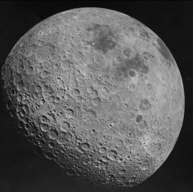
Lunar caves have emerged as a focal point of planetary exploration following media reports of an expansive subterranean cavern identified on the Moon. Remote orbital data reveals a deep surface depression within the Marius Hills, yet orbital instruments cannot independently confirm whether the opening leads into an intact lava tube. Determining whether the site is an isolated collapse or a vast conduit requires direct surface exploration and specialized sub-surface sounding.
Why AENIGMA is covering this
The prospect of subterranean structures on the Moon touches upon central questions in planetary science and space mission planning, making it an essential subject for factual evaluation. If intact lava tubes exist on the Moon, they offer natural radiation shielding, constant thermal conditions, and physical protection from incoming micrometeorites. Understanding whether these features are common conduits or rare, isolated depressions informs the long-term feasibility of human presence beyond Earth. However, public interest in space exploration often leads to exaggerated portrayals where tentative orbital detections are transformed into finished discoveries. Reporting on this topic serves to clarify how scientific observation differs from popular interpretation. By examining the technical limitations of orbital instruments—such as why a spacecraft hundreds of kilometres above a planet cannot see beneath a rocky shelf—readers gain a clear picture of how planetary science operates. Tracing the line between confirmed surface pits and speculative tunnel systems prevents premature conclusions from replacing verifiable facts. Clear reporting outlines the precise steps, instrumentation, and geological criteria needed before any site on another world can be classified as a usable subterranean cavern. Finally, examining the Marius Hills void highlights the role of comparative planetology in understanding terrestrial and extraterrestrial volcanic landscapes. Volcanic processes that shaped Earth's basaltic fields operated under different gravitational and environmental conditions on the Moon billions of years ago. Evaluating how terrestrial techniques translate to lunar survey efforts illustrates the rigorous multi-instrument methodology required to study inaccessible environments. Presenting the evidence calmly and precisely allows the public to appreciate the authentic challenges of planetary exploration without relying on unproven claims.
What happened
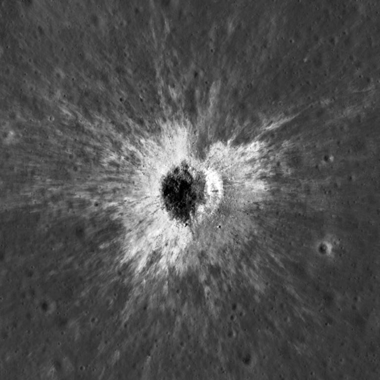
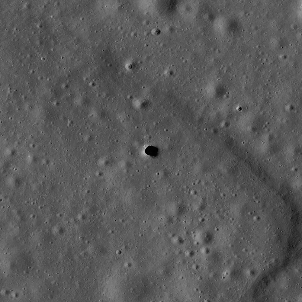
Recent coverage in Greek news outlets, including To Manifesto and SKAI, highlighted ongoing planetary investigations concerning a potential subterranean cavern beneath the lunar surface. The reports focused on satellite observations of the Marius Hills region, a known volcanic province on the Moon characterized by sinuous rilles and dome formations. According to these accounts, analysis of high-resolution orbital imagery and radar data suggests that an identified pit crater could provide an entrance into a preserved volcanic conduit. Such underground structures are frequently discussed in exploration roadmaps because thick layers of solid basalt would shield surface infrastructure from extreme temperature fluctuations, micrometeoroid strikes, and solar radiation. The feature in question appears in high-resolution orbital imagery as a steep-sided circular opening, often termed a skylight, set within a dry volcanic plain. These surface features occur in areas where basaltic lavas flowed billions of years ago during intense periods of lunar volcanism. As the outer crust of an active lava stream cooled and solidified in the lunar vacuum, molten material continued to drain underneath, potentially leaving behind an open conduit. If the roof of such a conduit thinned or suffered structural failure under subsequent impact shaking, a localized hole formed at the surface. Planetary scientists have long evaluated orbital datasets to catalogue these circular depressions across major volcanic provinces. While popular accounts frequently describe the site as a confirmed underground cave ready for human occupancy, the underlying scientific research focuses on interpreting surface geometry and indirect subsurface signals. The orbital missions tasked with studying the Moon gather photometric imagery, thermal emission readings, and radar reflections from hundreds of kilometres overhead. These remote sensing tools establish the existence of a dark, steep-sided opening at the Marius Hills site, but orbital vantage points cannot illuminate the space extending laterally beneath the basalt ceiling. The ongoing discussion centres on whether the opening represents a minor hollow or an entryway into a long volcanic passage.
What we know
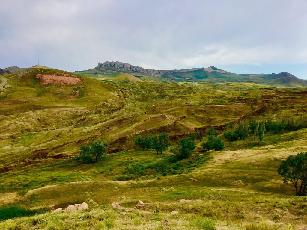
The physical reality of the surface pit within the Marius Hills region is firmly established through orbital imaging. Spacecraft orbiting the Moon have repeatedly photographed the feature from diverse sun angles, measuring its lateral diameter and observing shadows cast across its interior floor. These observations demonstrate that the pit possesses vertical or near-vertical walls cutting downward through successive layers of volcanic basalt. The surrounding terrain belongs to an ancient volcanic complex where past effusive eruptions produced low-viscosity lava plains, making the geological context consistent with volcanogenic hollows. Orbital radar sounders have also gathered data over the volcanic provinces of the Moon. Radar signals directed at the lunar surface penetrate into dry, porous regolith and solid basalt layers, reflecting back toward the spacecraft whenever they encounter sharp transitions in material density. Sounding profiles gathered over the Marius Hills region have registered subsurface echo patterns that deviate from uniform, solid bedrock. These reflections indicate variations in structural density beneath the immediate surface layer, suggesting the presence of either low-density rubble, fractured rock zones, or open space beneath the basalt cap. On Earth, comparable basaltic structures form regularly within volcanic regions such as Hawaii, Iceland, the Canary Islands, and the Pacific Northwest. Terrestrial lava tubes develop when liquid basalt at temperatures exceeding one thousand degrees Celsius crusts over against the cool atmosphere while the internal fluid core drains away downhill. Once volcanic activity ceases entirely, the empty conduit remains as an elongated cavern whose roof may collapse in sections, producing skylights that look identical to the lunar pits seen in orbital photographs. The physics governing fluid basalt flow applies equally to the Moon, where lower gravity could theoretically allow much larger stable caverns to endure over billions of years without collapsing.
What we don't know
Orbital observations cannot reveal the internal horizontal dimensions, floor topography, or structural continuity of the space beneath the Marius Hills opening. Satellite cameras look downward from orbit and capture only the illuminated floor of the pit when sunlight strikes at steep angles, leaving the lateral margins completely dark. Current imaging instruments cannot see beneath the overhangs to measure whether the cavern extends a few metres into surrounding rock or stretches for kilometres as an intact subterranean gallery. Any assessment of lateral tunnel length remains unverified until direct exploration probes beneath the basalt lip. The structural stability of the ceiling over time is similarly unknown. Over billions of years, the lunar crust has experienced relentless micrometeoroid bombardment, large impact shocks, and severe thermal stresses driven by day-night cycles that range from boiling heat to extreme cold. While low lunar gravity reduces the downward mechanical stress on basalt arches, seismic shaking from nearby asteroid collisions could have shattered fragile roofs. Orbital data cannot tell whether the conduit ceiling remains sound, has fractured into unstable slabs, or has collapsed entirely into a rubble-choked trench hidden below the surface opening. Scientists also lack definitive information regarding the interior composition and geometry of the pit floor. When a lava tube roof partially fails, the collapsed rock falls straight to the bottom, creating a mound of jumbled, sharp-edged basalt blocks. Remote sensing platforms cannot measure the thickness of this debris mound, nor can they determine whether the floor consists of smooth, frozen pahoehoe lava or impassable boulders. The presence of secondary mineral coatings, trapped volatile compounds, or electrostatic dust movement inside such shaded environments remains unmeasured due to the complete lack of in-situ surface data.
What is claimed
The accounts published in media outlets describe the Marius Hills depression as an entrance into a colossal, fully preserved underground cavern capable of housing long-term human infrastructure. These presentations frame the feature as an already verified, traversable conduit that spans substantial distances beneath the lunar ground. In popular framing, the pit is frequently portrayed not merely as a surface collapse, but as an intact natural shelter that stands ready to accommodate habitats, storage facilities, and scientific laboratories, shielded from cosmic rays and temperature extremes. Such narratives extrapolate heavily from theoretical structural modeling. Scientific studies on lunar speleology routinely calculate the maximum theoretical dimensions that a basaltic lava tube could attain under lunar conditions, showing that lower surface gravity could support vast underground voids spanning hundreds of metres in width. When these theoretical upper limits are combined with news coverage of an identified surface skylight, the resulting reports often treat the maximum hypothetical size as an observed physical reality. The media accounts present the presence of a massive, hollow conduit as an established certainty rather than an unproven hypothesis. Furthermore, popular reports often blend indirect radar reflections with direct observation. When orbital radar profiles detect subsurface dielectric boundaries, news summaries sometimes describe the instrument as having mapped out the interior halls of a cavern. In reality, radar sounding from orbit produces complex return signals that require extensive mathematical processing and geometric interpretation. The claims in media reports jump from the detection of anomalous radar reflections to the conclusion that an expansive, unobstructed tunnel network has been unequivocally charted.
What is verified
A careful distinction must be drawn between the confirmed surface geometry of the Marius Hills depression and the unverified hypothesis of an extensive subsurface conduit. The physical existence of a vertical pit measuring scores of metres across has been verified through multiple independent spacecraft missions. Photogrammetric analysis of shadow lengths confirms that the pit has significant depth, penetrating deep into the volcanic layering of the lunar mare. The pit is an authentic morphological feature, not an artifact of imaging processing or an optical illusion caused by low sun angles. The existence of an open, continuous subterranean tunnel connected to this opening remains entirely unverified. At present, the evidence supports two competing geological interpretations of equal validity. The first possibility is that the depression represents a true skylight into an ancient lava tube where large segments of the underground conduit remain open, structurally stable, and accessible beneath the solid basalt plain. Such a formation would correspond directly to terrestrial volcanic tube models scaled up to the lunar gravitational regime. The second competing explanation is that the Marius Hills opening is a localized, isolated collapse pit without extensive horizontal continuations. Such features develop when localized gas pockets form within cooling lava flows, or when structural fractures cause a pocket of regolith and broken basalt to drain downward into a small, restricted void. In this scenario, the underground void is small, filled with collapsed rock fragments, and lacks any significant lateral passageways. Current orbital datasets lack the resolving power to confirm or rule out either interpretation, leaving the subterranean continuity of the site unproven.
Competing explanations
- Possible: The Marius Hills pit represents a collapsed roof skylight providing access to an ancient, intact volcanic lava tube beneath the lunar surface.
- Possible: The feature is an isolated surface collapse pit or localized void that does not lead to an extensive, traversable subterranean tunnel system.
What would change our assessment
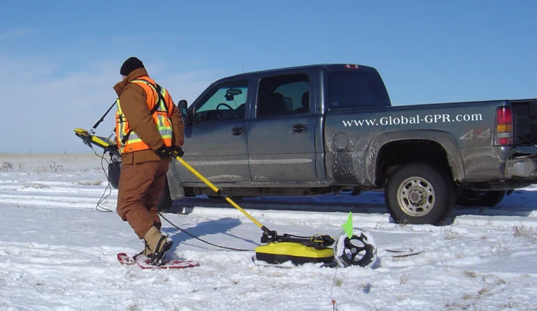
Resolving the true nature of the Marius Hills feature requires deploying dedicated surface geophysical instrumentation directly around the site. On Earth, geophysicists evaluate potential subterranean voids using multi-instrument survey strategies that combine active seismic sounding, surface ground-penetrating radar, and micro-gravimetry. A high-resolution ground-penetrating radar operating directly on the lunar surface, transported by an autonomous rover or lander, could send high-frequency electromagnetic pulses through the basalt ceiling to map the precise boundary between solid rock and open space below. Micro-gravimetric surveys would provide an additional decisive layer of evidence. Because an open subterranean cavern represents a missing mass beneath the surface, a precision gravimeter moved across the terrain would register a distinct, localized negative gravity anomaly directly above an open conduit. If the subsurface feature were merely a zone of fractured rock or a shallow, filled depression, the gravitational signature would differ markedly from that of a hollow tunnel. Combining micro-gravimetry with surface seismic experiments, where small vibrations are recorded by an array of geophones, would determine whether the bedrock is intact or fragmented. Ultimately, absolute confirmation would arrive with in-situ robotic exploration entering the pit itself. Tethered rovers, robotic rappelling systems, or autonomous drones designed to navigate without satellite positioning could descend past the basalt lip to inspect the overhangs directly. Equipped with optical cameras, structured light scanners, and LiDAR systems, such an explorer could sweep the interior darkness, measure the lateral extension of the void, map floor topography, and assess rock mechanics in real time. Until such surface missions deploy to the Marius Hills, the question of whether the pit leads to an expansive cavern will remain an open hypothesis.
Sources
- Το Μανιφέστο (supports)
- ΣΚΑΪ (supports)
Protocol AENIGMA-EF-0.1