Evidence: Insufficient data Explanation: Not enough data yet
Lake Issyk-Kul sunken city: What the Silk Road ruins really show
The sunken Silk Road city in Lake Issyk-Kul has yielded artifacts like pottery and a 'tuvaq' from the Karakhanid era. Researchers are exploring whether the settlement was submerged by a landslide or a tectonic dam following a seismic disaster. Current data remains insufficient to definitively explain the sudden inundation of this medieval site.
Why AENIGMA is covering this
The submerged settlement in Lake Issyk-Kul offers a rare window into the material culture of the Karakhanid Khanate and the daily realities of life along the Silk Road. While monumental architecture and historical texts often dominate the narrative of medieval Central Asia, everyday objects like the tuvaq and domestic pottery provide an intimate connection to the people who inhabited these vital trade corridors. Understanding how these communities lived, traded, and adapted to their environment is essential for a complete picture of Eurasian history. Furthermore, the site presents a compelling case study at the intersection of archaeology and geology. The theories surrounding its submergence highlight the profound impact that tectonic activity and environmental shifts can have on human settlements. By investigating the fate of this Issyk-Kul community, researchers can gain broader insights into how historical populations responded to natural disasters and changing landscapes. The ongoing study of these underwater ruins not only enriches the historical record of Kyrgyzstan and the wider region but also underscores the importance of interdisciplinary approaches in uncovering the past. As new technologies allow for more detailed exploration of submerged environments, sites like this one will continue to yield valuable information about the complex relationship between human societies and the dynamic planet they inhabit.
What happened
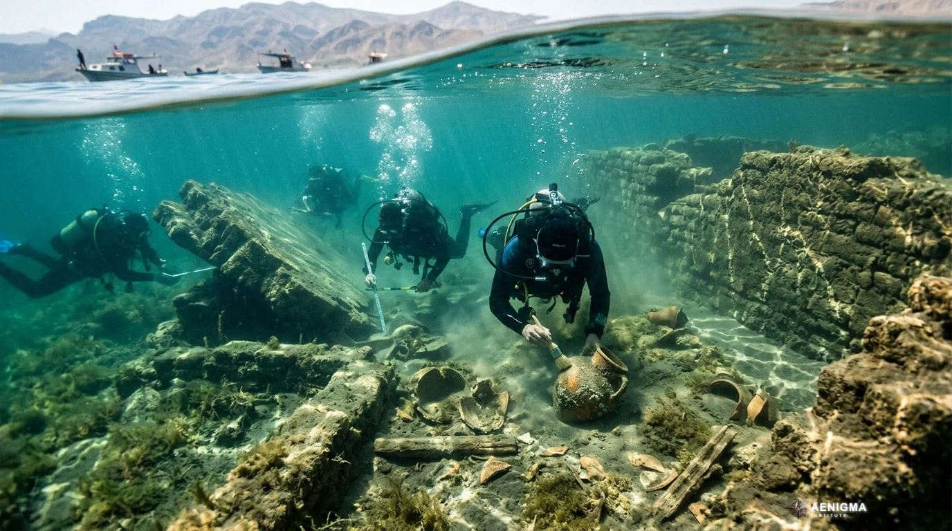
Lake Issyk-Kul, a massive alpine lake in the Tien Shan mountains of Kyrgyzstan, holds the remains of a medieval settlement beneath its waters. Recent underwater surveys have brought attention to this submerged site, which dates back to the era of the Karakhanid Khanate. Among the items recovered from the lakebed are various pieces of pottery and a specific ceramic vessel known as a 'tuvaq'. These artifacts provide a direct glimpse into the daily domestic life of a settlement that once thrived along the northern routes of the Silk Road. The Karakhanid Khanate was a prominent Turkic dynasty that ruled Central Asia from the late ninth to the early thirteenth century. During their reign, the region experienced significant urban development, with cities and waystations flourishing to support the lucrative transcontinental trade networks. The presence of everyday items like the tuvaq—a traditional chamber pot or specialized vessel—indicates a permanent, settled population rather than a temporary encampment. Underwater archaeology in such environments presents unique logistical and technical challenges. Lake Issyk-Kul is an endorheic basin, meaning it has no outflow, and its water levels have fluctuated dramatically over the centuries due to climatic shifts and tectonic activity. The cold, slightly saline waters of the lake help preserve ceramic and structural remains, allowing researchers to study the layout and material culture of the submerged settlement. Divers and marine archaeologists map the debris fields using underwater photography and photogrammetry to create three-dimensional models of the site. The recovery of intact pottery from the lake floor requires careful handling and specialized conservation techniques, as waterlogged materials can degrade rapidly once exposed to the air and changes in pressure. By analyzing the style, glaze, and firing techniques of the ceramics, specialists can place the settlement firmly within the broader chronology of Karakhanid material culture. The process of documenting these finds is slow and methodical, relying on brief diving windows dictated by weather and water clarity.
What we know
The artifacts recovered from the depths of Lake Issyk-Kul belong to a well-documented period of Central Asian history. The Karakhanid era marked a time of profound cultural synthesis, where nomadic Turkic traditions blended with settled Islamic urbanism. This period saw the construction of significant architectural monuments across Central Asia, such as the Burana Tower, which stands as a testament to the engineering and artistic capabilities of the time. While the submerged site at Issyk-Kul may not feature such monumental structures, the pottery recovered is often characterized by distinct geometric patterns, calligraphy, and the use of slip-painted decoration under a transparent glaze. The ceramics found at the submerged site align perfectly with these regional styles, confirming the settlement's integration into the wider economic networks of the time. The identification of a tuvaq among the finds is particularly notable. In traditional Central Asian households, such vessels were used for hygiene and infant care, pointing to the presence of families and established domestic routines. This reinforces the understanding that the site was a fully functioning community, likely serving as an agricultural hub or a trading post for merchants navigating the mountain passes. Lake Issyk-Kul itself is a defining feature of the regional geography. Situated at an altitude of over 1,600 meters, it is one of the largest deep mountain lakes in the world. Its name translates to 'warm lake' in the Kyrgyz language, a reference to the fact that it never freezes, even in the harsh winters of the Tien Shan, due to its depth and slight salinity. This reliable body of water made the surrounding basin an attractive location for human habitation for millennia. The Silk Road was not a single path but a complex web of routes, and the Issyk-Kul basin offered a vital corridor connecting the Tarim Basin in the east with the Fergana Valley and the steppes to the west. Settlements around the lake would have provisioned caravans, traded local goods, and facilitated the movement of silk, spices, and horses. The physical remains on the lakebed consist of scattered building materials, foundations, and ceramic scatters. These underwater ruins have been known to locals and researchers for decades, prompting various expeditions to map the submerged topography. The preservation of heavy ceramics and structural stones provides a tangible record of the Karakhanid presence, even as the organic materials have largely been lost to time and water action.
What we don't know
Despite the physical evidence of the settlement, the exact sequence of events that led to its inundation remains unclear. The current data is insufficient to establish a precise timeline for when the city was abandoned or submerged. It is not known whether the water level rose gradually over decades, prompting a slow evacuation, or if a sudden catastrophic event inundated the area overnight. The lack of comprehensive stratigraphic data from the lakebed makes it difficult to pinpoint the exact decade or even century of the submergence. Furthermore, the full spatial extent of the underwater ruins has yet to be definitively mapped. While specific clusters of artifacts and building materials have been located, the boundaries of the original settlement are obscured by centuries of sediment accumulation and underwater currents. It is unknown how many structures remain buried beneath the lake floor or what proportion of the city was lost to the rising waters. The demographic profile of the settlement is also a subject of ongoing inquiry. While the presence of domestic pottery indicates a settled population, the size of the community, its primary economic drivers, and its administrative status within the Karakhanid Khanate are not fully understood. There are no surviving textual records that can be conclusively linked to this specific underwater site, leaving researchers reliant entirely on the material record. The environmental conditions of the Issyk-Kul basin during the medieval period are also not entirely resolved. Paleoclimatologists study lake terraces and sediment cores to reconstruct past water levels, but correlating these broad environmental shifts with the specific occupational history of the submerged settlement requires more detailed chronological markers than are currently available.
What is claimed
Researchers studying the site have proposed several explanations for the sudden submergence of the medieval settlement. One prominent theory suggests that the city sank to the bottom of the lake following a massive landslide. The Tien Shan mountains are characterized by steep, unstable slopes, and a large-scale mass movement of earth and rock could have displaced a significant volume of water or altered the local shoreline, dragging the settlement into the lake. Another explanation posits that the area was flooded by a tectonic dam triggered by a seismic disaster. Central Asia is a highly active tectonic zone, where the ongoing collision of the Indian and Eurasian tectonic plates creates immense geological stress across the Tien Shan range. According to this scenario, a powerful earthquake could have caused a massive rockfall or landslide that blocked a river draining into or out of the basin, or altered the subterranean hydrology of the area. This blockage would create a natural dam, causing the water levels in the lake or a localized area to rise rapidly and permanently inundate the settlement. Tectonic dams can form in a matter of hours or days, leaving inhabitants with little time to evacuate and resulting in the sudden preservation of a settlement beneath the rising waters. These geological theories attempt to account for the seemingly abrupt end to the site's occupation. Proponents of the seismic disaster theory point to the historical record of devastating earthquakes in the region, which have been known to reshape the landscape, alter river courses, and destroy entire cities. The idea is that the settlement did not simply succumb to a gradual climatic shift, but was the victim of a sudden, violent geological event that trapped its infrastructure and everyday objects, like the tuvaq, in place.
What is verified
What is physically verified is the presence of medieval artifacts on the bed of Lake Issyk-Kul. The recovery of Karakhanid-era pottery and the tuvaq confirms that a settled community existed in this location between the ninth and thirteenth centuries. The stylistic and material analysis of these ceramics securely dates them to this period, aligning with the known historical occupation of the Issyk-Kul basin by the Karakhanid Khanate. It is also a verified geological fact that the Issyk-Kul basin is situated in a seismically active region. The Tien Shan mountain range experiences frequent earthquakes, and the landscape bears the scars of historical tectonic activity, including fault lines and ancient landslide deposits. The mechanics of tectonic damming and earthquake-induced landslides are well-documented phenomena in mountainous environments worldwide, making them plausible mechanisms for sudden landscape alteration. The endorheic nature of Lake Issyk-Kul is another established fact. Because the lake has no outlet, its water level is highly sensitive to changes in climate, precipitation, and tectonic shifts that might alter the inflow from surrounding rivers. Historical and geological records confirm that the lake's water levels have fluctuated by dozens of meters over the past few millennia. The physical characteristics of the recovered artifacts, such as the waterlogged state of the ceramics and the specific types of glazes used, have been documented by the researchers who retrieved them. These objects are tangible pieces of evidence that support the existence of the submerged site, even if the exact mechanism of its destruction remains a subject of investigation.
Competing explanations
- Possible: The settlement sank to the bottom of the lake following a landslide or was flooded by a tectonic dam triggered by a seismic disaster.
What would change our assessment
To move beyond the current state of insufficient data, researchers would require a combination of high-resolution geological mapping and precise chronological dating. A comprehensive bathymetric survey of the lakebed, utilizing advanced multibeam sonar and sub-bottom profiling, could reveal the full extent of the submerged ruins and identify any geological features associated with a landslide or tectonic dam. If a massive underwater landslide deposit or the remnants of a natural dam were located in close proximity to the settlement, it would strongly support the catastrophic inundation theories. Furthermore, obtaining precise dates for the submergence event is crucial. This could be achieved through radiocarbon dating of any surviving organic materials found in direct association with the submerged structures, such as wooden beams or botanical remains. If the dates of the latest occupation layer align closely with known seismic events in the region, it would bolster the theory of an earthquake-triggered disaster. The field of paleoseismology, which studies ancient earthquakes through geological sediments and fault lines, could provide critical context. By trenching nearby fault zones and dating past ruptures, geologists could determine if a major earthquake occurred concurrently with the settlement's demise. Detailed sediment core analysis from the lakebed could also provide a high-resolution record of environmental changes. By identifying specific layers of sediment associated with sudden influxes of material or rapid changes in water chemistry, paleoclimatologists could pinpoint the exact timing and nature of the water level rise. Additionally, a wider excavation of the underwater site, recovering a larger sample of artifacts and mapping the spatial distribution of the ruins, would help clarify whether the settlement was abandoned hastily or gradually. The discovery of items typically taken during a planned evacuation would suggest a slow rise in water levels, while the presence of valuable goods and intact domestic assemblages left in situ would point toward a sudden, catastrophic event.
Sources
- Phys.org (supports, primary)
Protocol AENIGMA-EF-0.1