Evidence: Unsubstantiated Explanation: Not enough data yet
Cosmos 2612 and what the close approach to ICEYE really shows
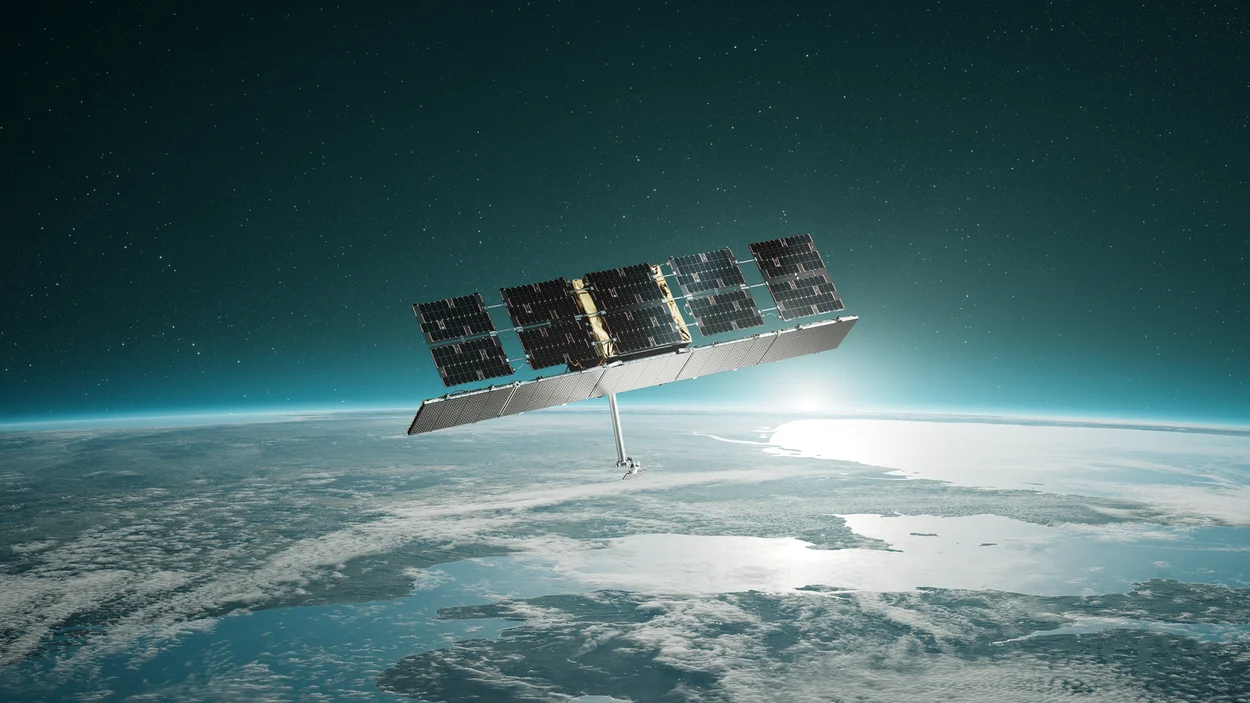
Cosmos 2612, a Russian satellite, reportedly executed close maneuvers near an ICEYE commercial radar spacecraft, reaching an estimated separation distance of roughly 500 meters. Reports published by TechNews and Scientific American highlight growing concerns over non-consensual proximity operations in low-Earth orbit. While orbital mechanics confirm deliberate proximity maneuvers, the underlying mission objectives and payload activities remain unverified.
Why AENIGMA is covering this
The close pass between Cosmos 2612 and the ICEYE satellite highlights an important evolution in outer space security, where commercial satellites operating in low-Earth orbit increasingly intersect with military space activities. As private companies launch constellations that provide near-continuous radar, optical, and communication coverage, their infrastructure inevitably enters the strategic calculations of sovereign powers. Examining the verifiable astrodynamics of these events separates clear physical data from alarmist speculation. Rendezvous and proximity operations present distinct regulatory and safety challenges for the international space community. Unlike terrestrial borders or airspace corridors, outer space lacks clearly established buffer zones, right-of-way rules, or internationally mandated safety perimeters. When a state-owned satellite approaches an uncrewed commercial asset without public coordination, the incident tests the boundaries of established space law and raises operational concerns regarding collision avoidance and orbital debris generation. A clear understanding of such events requires untangling what is known through tracking telemetry from what is assumed based on geopolitical tensions. Space situational awareness systems provide remarkable insight into orbital trajectories, but interpreting intention demands rigorous scrutiny of available evidence. Following these developments allows observers to monitor how spacefaring nations navigate the fragile balance between national security maneuvers, commercial safety, and long-term sustainability in Earth orbit.
What happened
Commercial and military tracking monitors recently recorded an unannounced rendezvous in low-Earth orbit involving Cosmos 2612, a Russian spacecraft, and an active synthetic aperture radar satellite operated by the commercial firm ICEYE. Over an extended orbital trajectory, the Russian vehicle adjusted its velocity and inclination to match the target's orbital plane. Telemetry compiled from tracking networks showed the two objects closing to an estimated minimum distance of approximately 500 meters. Media reports from TechNews and Scientific American brought the incident into broader view, noting that the close pass represents an assertive demonstration of rendezvous and proximity operations directed against commercial space infrastructure. Commercial synthetic aperture radar platforms provide continuous day-and-night surface imagery regardless of cloud cover, making them vital assets for observation, disaster management, and security intelligence. The positioning of an uncrewed inspector satellite alongside such an asset inevitably sparks international scrutiny. Non-consensual orbital approaches of this kind are rarely accompanied by public operational statements from the maneuvering state. The event unfolded silently in the vacuum of low-Earth orbit, documented through ground-based optical tracking, passive radio monitoring, and radar cross-section analysis. Observers across the aerospace sector watched the maneuvers unfold as Cosmos 2612 fine-tuned its relative position over several orbital cycles, settling into an co-orbital holding pattern that maintained proximity to the commercial radar craft. Public discourse around the event quickly expanded from technical telemetry assessments into debates regarding modern counter-space tactics. Observers drew connections between commercial imagery operations supporting conflict monitoring and state-sponsored orbital harassment. While the physical trajectory of the two platforms is demonstrable through public astrodynamics data, the precise operational goals driving the mission remain subject to interpretation across defense and civilian aerospace communities.
What we know
The physical reality of the rendezvous is anchored in orbital tracking data maintained by public space surveillance networks. When two satellites share similar orbital inclinations and altitudes, calculating their relative distance relies on well-understood principles of celestial mechanics and radar tracking. Public tracking logs indicate that Cosmos 2612 performed deliberate propulsion burns that actively matched the orbital plane and altitude of the ICEYE satellite over a succession of weeks. These adjustments demonstrate that the close approach was not an accidental conjunction or a random consequence of orbital decay. In low-Earth orbit, unpowered objects follow predictable Keplerian paths governed by Earth's gravitational field and atmospheric drag. To transition from a distinct trajectory into a synchronized path that maintains a 500-meter separation requires active, commanded propulsion maneuvers and continuous orbital navigation. The hypothesis of an accidental orbital alignment is ruled out by the series of repeated thruster burns and relative plane-matching maneuvers recorded in tracking telemetry. Synthetic aperture radar satellites such as ICEYE function by transmitting microwave pulses toward Earth's surface and measuring the return echoes to construct high-resolution synthetic images. Because they emit electromagnetic signals rather than merely capturing visible light, their sensors are technically distinct from traditional optical observation platforms. Spaceborne synthetic aperture radar has increasingly become a critical tool for environmental monitoring, maritime tracking, and geopolitical surveillance. Tracking agencies and commercial space situational awareness firms regularly monitor rendezvous and proximity operations to evaluate collision risks and protect operational assets. Standard orbital surveillance tools—including ground-based phased-array radars, optical sensor arrays, and space-based situational awareness cameras—can determine the relative positioning, drift rates, and velocity vectors of orbiting platforms with high precision. These instruments established that the two vehicles converged and sustained close proximity for a measurable period.
What we don't know
Orbital tracking systems measure trajectories, not internal payloads or commanded intentions. While telemetry confirms that Cosmos 2612 approached to within 500 meters of the ICEYE satellite, sensors on the ground cannot reveal the exact equipment operating aboard the Russian craft. It remains unknown whether Cosmos 2612 carried optical inspection cameras, electronic eavesdropping packages, localized radio-frequency transmitters, or strictly inert navigation payloads. Ground tracking data cannot confirm whether active radio transmissions or localized sensor jamming occurred during the encounter. A spacecraft positioned 500 meters from a radar satellite occupies an advantageous vantage point for gathering electronic intelligence or attempting local frequency interference, but verifying such activity requires specialized radio-frequency spectrum monitoring. Public tracking records contain no conclusive telemetry proving that Cosmos 2612 broadcast interfering signals or sought to blind the radar receiver of the ICEYE platform. The long-term strategic objectives governing the mission are similarly unconfirmed. Observers debate whether the close approach was designed as a technical rehearsal for future rendezvous missions, an effort to inspect the physical architecture of the commercial radar satellite, or an intentional show of counter-space reach intended to deliver a political warning. Without official technical disclosures from the operating nation or detailed telemetry releases from the operator of the target satellite, analysts cannot definitively establish the motive behind the flight profile. It is also unknown whether the maneuvering spacecraft attempted any contact or interaction beyond passive station-keeping. Assessing whether the approach produced thermal changes, physical disturbances, or communication anomalies on the ICEYE satellite would require operational telemetry from the satellite's commercial operators. Until proprietary platform logs or independent electronic monitoring records are made public, those operational dimensions remain unverified.
What is claimed
Coverage from media outlets, including TechNews and Scientific American, has emphasized several competing narratives regarding the nature of the encounter. A prominent assertion is that Cosmos 2612 carried out deliberate, non-consensual rendezvous and proximity operations to shadow, inspect, or intimidate a commercial satellite known to provide radar observations relevant to the conflict in Ukraine. Under this view, the operation serves as a demonstration of counter-space capabilities designed to signal that private assets are vulnerable in orbit. Another claim posits that the Russian vehicle positioned itself within 500 meters to conduct localized electronic warfare testing or signal intelligence collection. Proponents of this explanation suggest that close physical proximity allows an inspector vehicle to capture low-power sidelobe transmissions from radar antennas or to test low-power directional jamming techniques that might be undetectable by broad ground monitoring networks. This scenario portrays the encounter as an operational evaluation of orbital electronic countermeasures. A third narrative raised in casual discussions suggested that the event might have resulted from incidental orbital overlap or routine orbital drift within high-density low-Earth orbit bands. However, astrodynamics specialists have challenged this interpretation. Technical tracking data demonstrated deliberate, repeated burns that actively synchronized the spacecraft's orbital parameters with the target, eliminating natural alignment as a plausible explanation. Industry commentators have also framed the incident as a precedent-setting challenge to international space norms. Commentators argue that by approaching an uncrewed commercial platform without prior coordination, the maneuvering nation exploited legal grey areas in the Outer Space Treaty, which guarantees freedom of exploration but provides few explicit boundaries regarding minimum operational distances between independent spacecraft.
What is verified
Only specific aspects of the encounter are verified by empirical tracking data. Ground-based space situational awareness systems verified that Cosmos 2612 carried out active orbital maneuvers that brought its trajectory into close spatial alignment with the ICEYE satellite. Independent radar and optical observations recorded the orbital plane matching, the gradual convergence, and the minimum estimated separation distance of approximately 500 meters. Verification does not extend to speculative interpretations of payload operations or hostile intent. Tracking networks measure orbital state vectors—velocity, altitude, inclination, right ascension of the ascending node, and eccentricity—which demonstrate the physical reality of the rendezvous. They do not demonstrate that an anti-satellite weapon test, electronic attack, or harmful physical interference took place. The claim that the approach was an accidental alignment caused by passive orbital drift is contradicted by observed flight dynamics. Telemetry shows multiple orbital plane matching maneuvers and altitude adjustments executed over several weeks, confirming that the rendezvous was deliberate. Beyond the physical trajectory, claims asserting electronic jamming, intelligence harvesting, or political posturing remain unverified hypotheses supported by circumstantial geopolitical context rather than conclusive telemetry. International aerospace records confirm that commercial radar satellites, including those built by ICEYE, have become integral components of modern Earth observation architecture. Verification of the platforms' operational roles and trajectories is well established in public registries. However, the precise operational goals pursued by the operators of Cosmos 2612 during this specific pass remain formally unconfirmed.
Competing explanations
- Possible: Cosmos 2612 conducted deliberate non-consensual rendezvous and proximity operations to inspect, shadow, intimidate, or demonstrate counter-space capability against a commercial radar satellite aiding Ukraine.
- Possible: The maneuver was intended to test local frequency interference or sensor jamming in close proximity, though tracking data alone does not confirm active transmission.
- Ruled out: Tracking telemetry showed multiple active orbital plane matching maneuvers and altitude adjustments over weeks, ruling out accidental alignment.
What would change our assessment
The current evaluation of the incident as an unverified mission intent with verified orbital mechanics would change if direct empirical data regarding the payload interaction became available. Publication of time-stamped radio-frequency monitoring data from independent ground receiving stations, showing directional electromagnetic emissions or interference patterns aligned with the rendezvous, would alter the assessment regarding electronic warfare or signals intelligence gathering. Similarly, technical disclosures from the operators of the ICEYE satellite would provide critical clarity. If mission operators published diagnostic logs showing telemetry anomalies, receiver saturation, optical flash observations, or unexpected sensor noise during the period of closest approach, the hypothesis of active interference would gain substantial weight. Conversely, an operational report showing completely normal, uninterrupted radar operations throughout the encounter would support the interpretation that Cosmos 2612 acted purely as an observational or passive inspection platform. Declassification or technical publication of mission telemetry and instrument specifications by the Russian space agency or military operators would fundamentally resolve the debate over intent. Providing verified engineering records detailing the onboard payloads—such as inspection cameras, navigation sensors, or communication packages—would establish whether the spacecraft was outfitted for inspection, intelligence, or general technology demonstration. Broad consensus among international space tracking bodies regarding precise relative attitudes and sensor orientations between the two platforms would also refine current models. High-resolution ground-based inverted synthetic aperture radar images or space-to-space optical tracking revealing which way Cosmos 2612 pointed its instruments during the flyby would show whether its sensors were oriented directly at the commercial satellite's antenna arrays.
Sources
- TechNews 科技新報 (supports)
- Scientific American (supports)
Protocol AENIGMA-EF-0.1