Publisher news
This article is about the publisher's own company. Source: official decision.
X6 Ground Scanner and NOETIC Field Software in Modern Archaeology
X6 ground scanner hardware and the NOETIC field software suite establish local data retention and structured documentation protocols for non-invasive archaeological surveys. Modern subsurface prospection relies on secure data handling to map subterranean physical anomalies without disturbing delicate stratigraphic sequences. The platform integrates field recording with hardware operations, prioritizing data sovereignty across research environments.
Why AENIGMA is covering this
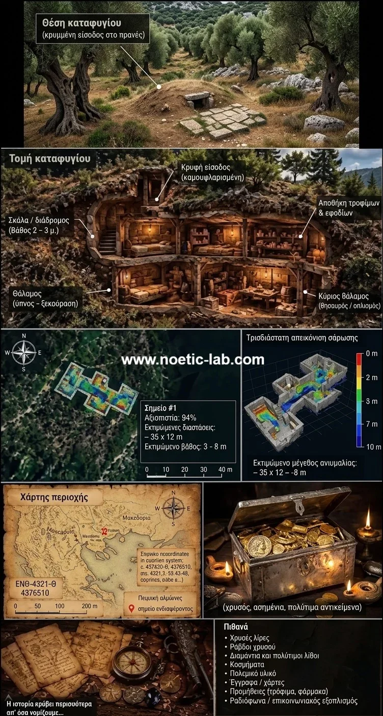
The evolution of non-invasive exploration tools represents a critical development in cultural preservation, making it an essential subject for AENIGMA. Understanding ancient civilizations no longer depends solely on trenching and physical extraction; modern field research increasingly relies on advanced sensing, spatial modeling, and secure digital archiving. Exploring how new technologies capture historical landscapes without altering delicate archaeological context provides our readership with a clear view of modern heritage management. Covering the NOETIC suite and the X6 ground-scanning system highlights how rigorous technical design supports responsible field methodology. Ensuring local data custody and producing accurate spatial records allows heritage specialists to study the past while safeguarding sensitive sites from outside exposure. Non-destructive prospection bridges the gap between historical inquiry and modern landscape preservation, offering researchers the tools necessary to map subsurface cultural horizons responsibly and systematically. Public interest in subterranean exploration frequently intersects with misconceptions regarding the role of modern instrumentation in heritage research. Popular media often portrays ground scanning as an automated search tool for valuable subterranean artifacts. In contrast, scientific journalism must emphasize that geophysical instruments function as analytical devices designed to map physical variations and preserve cultural heritage within legitimate scientific frameworks. Examining how data protection protocols function within field surveying equipment illuminates broader questions of technological sovereignty in scientific research. As digital technologies become central to heritage documentation, managing intellectual property and sensitive geospatial data locally is an operational priority. Documenting platforms that prioritize local data retention informs the broader discourse surrounding responsible technological adoption in the humanities.
What happened
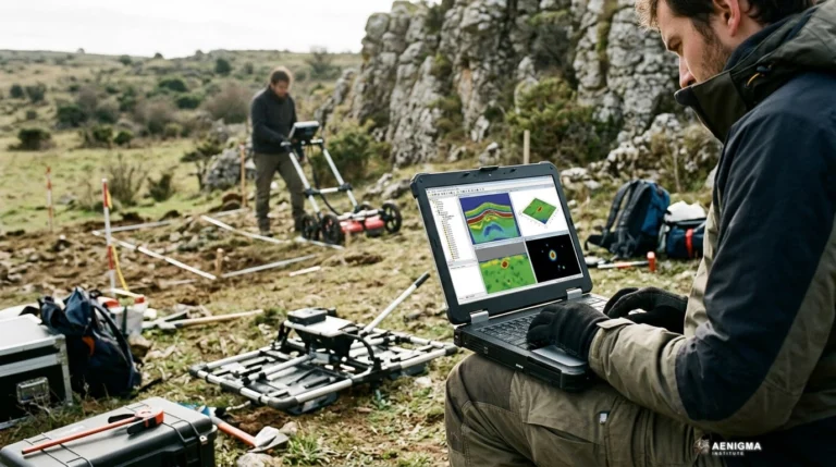
NOETIC Lab has introduced its software suite designed for archaeological field recording, coupling local data retention architecture with the X6 ground-scanning system. Non-destructive prospection methods have steadily become central to contemporary heritage management over recent decades. Traditional excavation, while fundamental to understanding the past, permanently removes stratigraphy and physical context during the recovery process. Heritage professionals increasingly turn to geophysical mapping and spatial documentation to chart subsurface physical features before any physical intervention is considered. The introduction of this integrated platform addresses long-standing operational hurdles in field data capture. In conventional campaigns, survey teams often coordinated observations using disparate notebooks, isolated digital cameras, hand-drawn site sketches, and separate data-logging devices. Transferring those varied records into central repositories frequently exposed research projects to administrative delays or inadvertent data security gaps. By utilizing local data handling that functions without requiring external cloud synchronization, the system retains spatial maps, scan passes, and notes directly on field devices. This workflow brings immediate digital consolidation to non-invasive investigations across diverse landscapes. The X6 ground-scanning system collects subsurface variation readings along calibrated survey lines, feeding raw measurements into the processing tools on the connected console. Field directors can review spatial representations within minutes of completing a grid pass, allowing them to verify data completeness while remaining on site. The resulting reports provide structured documentation that meets contemporary cultural resource inventory requirements without relying on remote network connections. Archaeological institutions increasingly demand closed-loop data pipelines to protect sensitive cultural assets from unauthorized exploitation. Unreleased spatial data that outlines buried structural anomalies poses significant risks if accessed outside authorized institutional frameworks. By restricting storage to authorized local hardware, research teams preserve administrative control over raw geophysical files and geospatial coordinates. The platform reflects an industry-wide push toward comprehensive, privacy-first technical ecosystems that support systematic scientific recording in varied field environments. Methodological standards in field archaeology have continually evolved toward non-destructive alternatives over the past half-century. Early archaeological investigations in the nineteenth and early twentieth centuries relied almost exclusively on destructive trenching, which stripped away contextual soil matrices forever. In contrast, modern cultural resource management frameworks mandate that heritage managers document landscapes non-invasively whenever possible to preserve undisturbed deposits for future generations. Integrating digital spatial records with geophysical instruments transforms how field projects handle baseline surveys. Field practitioners traditionally spent weeks post-processing spatial datasets on desktop workstations far from the survey area, creating delays between measurement collection and physical evaluation. With local processing enabled directly on field hardware, survey teams can identify anomalies, cross-reference environmental features, and adapt survey grids dynamically in real time.
What we know
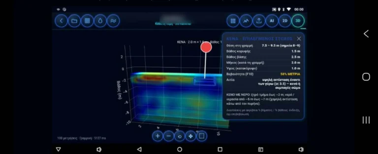
The NOETIC suite structures the collection of field measurements into standardized spatial formats directly on field devices. When researchers deploy the X6 ground-scanning system, the instrument measures subtle subsurface physical variations across a defined grid. These measurements are processed locally to produce visual representations of subterranean physical contrasts, including soil density shifts, buried masonry alignments, or void spaces. Because processing and storage occur entirely within local hardware memory, no telemetry or survey geometry leaves the survey perimeter during operations. Local data sovereignty addresses key legal and security standards governing modern archaeological site management. In many jurisdictions, national antiquity laws treat precise spatial records of unexcavated sites as sensitive cultural property subject to strict dissemination rules. Transmitting unencrypted survey boundaries or anomaly coordinates across third-party cloud infrastructure can inadvertently violate regional compliance mandates or expose unexcavated cultural deposits to unauthorized interference. Maintaining local retention ensures that project directors, academic institutions, and regional antiquities boards retain absolute custody over their geospatial archives. Subsurface imaging provides critical structural context that guides systematic research strategies without disturbing the ground. Non-invasive prospection maps the geometric outlines of stone walls, historic ditches, ancient pathways, and structural foundations without disturbing overlying topsoil. This broad perspective enables heritage teams to evaluate the spatial organization of historic settlements, agricultural terraces, and industrial complexes in their environmental setting. Having access to high-resolution anomaly grids prevents unnecessary disturbance to culturally significant landscapes. Geophysical instruments operate as analytical aids within licensed heritage projects rather than substitutes for formal archaeological oversight. The data generated by the X6 ground-scanning system maps contrasts in the subsurface, serving as a technical guide that complements stratigraphical analysis and historical archives. These spatial records allow research teams to assess subsurface features systematically, identifying anomalies worthy of conservation monitoring while leaving intact archaeological deposits undisturbed beneath the soil. Geophysical survey methods have deep roots in professional heritage science, expanding rapidly since the mid-twentieth century. Early surveys relied on basic resistivity meters and early seismic equipment to identify large buried structures. Over subsequent decades, advancements in digital processing, sensor sensitivity, and automated positioning systems transformed non-invasive exploration into a primary investigative discipline. Modern field prospection operates alongside geographic information systems (GIS) to integrate multiple layers of landscape data. Aerial photography, satellite remote sensing, surface artifact distributions, and subterranean geophysical grids are brought together to create multi-scalar representations of past human activity. When conducted methodically, non-invasive prospection protects fragile stratigraphy while yielding extensive cartographic data across entire settlement areas.
What we don't know
Despite the precision of modern scanning instrumentation, underground environments present variable physical conditions that influence data collection. Subsurface readings depend on local soil conductivity, moisture levels, salinity, mineral composition, and nearby modern electromagnetic activity. Heavy clay layers, waterlogged horizons, or dense basalt beds can dampen signals or create complex structural reflections that require careful post-processing. Because of these complex geological factors, how deep a source lies remains uncertain until evaluated through physical excavation or coring. The precise cultural identity, chronological period, and historical function of a mapped anomaly cannot be determined from geophysical imagery alone. An instrument can accurately delineate a rectilinear void or a dense subterranean wall, but it cannot differentiate between ancient masonry, historic drainage, or modern civil infrastructure without direct stratigraphical evidence. Geophysical maps indicate where physical differences occur beneath the surface, yet interpreting the cultural significance of those patterns relies entirely on contextual historical and archaeological study. The deployment of ground-scanning technology carries strict legal responsibilities that apply across all regions. Conducting field prospection, scanning, or surface surveying requires prior explicit permission from landowners alongside official survey permits issued by relevant cultural ministries and archaeological services. Operating non-invasive equipment does not convey permission to traverse protected boundaries, archaeological reserves, or private property without authorization. Technological tools must always function strictly within established statutory and ethical boundaries. The NOETIC suite provides technical tools for documented, lawful site management, and its use must comply with regional cultural preservation laws. Instrument operators are legally bound to follow professional codes of conduct and statutory permitting procedures, ensuring that technological investigations respect the physical and cultural sovereignty of the surveyed terrain. Natural geological variations can frequently mimic human-made subterranean features on survey readouts. Linear bedrock fractures, compacted alluvial deposits, ancient river channels, and tree root networks can produce geometric reflections resembling anthropogenic constructions. Without stratigraphic ground-truthing, researchers cannot definitively attribute an underground contrast to past human building activities based on raw scan profiles alone. Environmental variables also fluctuate between seasons, altering the subsurface physical contrasts recorded during prospection. A survey conducted during an arid summer may yield markedly different electrical and magnetic contrasts compared to measurements taken across the same terrain after winter rains. These environmental dynamics mean that single-pass surveys provide a temporary snapshot of physical differences rather than an unchanging picture of buried horizons.
What is claimed
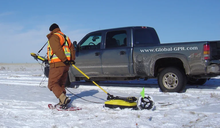
NOETIC Lab describes the X6 ground-scanning system as an advanced surveying platform designed for demanding field applications. The development team emphasizes that combining the specialized software suite with the X6 hardware series simplifies surveying workflows by removing the need for external secondary computing units during fieldwork. The manufacturer notes that models within the range, including the X6 Plus, X6 Raptor, X6 AI, and X6 Army Edition, are engineered to maintain high measurement fidelity across demanding topographies, ranging from arid stone plains to dense temperate forest cover. Field users and surveying professionals have highlighted the physical durability of the instruments under difficult environmental conditions. Survey teams report that the hardware casing and sensor assemblies withstand significant dust, humidity, and temperature variations without loss of operational capability. Furthermore, users frequently note that the real-time visual feedback provided by the mobile application allows team leaders to identify data gaps or sensor drift immediately, saving operational time during short field seasons. NOETIC Lab reports that the platform's user interface was constructed to meet the requirements of academic research groups, professional land surveyors, and licensed heritage practitioners alike. By pairing rapid field setup with automated grid calibration routines, the system aims to lower the barrier to thorough, standardized site documentation. The publisher maintains that integrating secure data recording with high-fidelity subsurface scanning provides a modern technical solution for researchers conducting non-invasive spatial analysis. Practitioners working in rugged environments have praised the platform's portability during extended overland surveys. Transporting bulky analytical equipment across remote mountain terraces or dense scrubland has traditionally limited the scope of regional surveys. Independent surveyors report that lightweight sensor configurations reduce logistical overhead, enabling broader survey coverage across difficult terrains within limited operational windows. Software responsiveness during active data acquisition represents another operational feature noted by field teams. Surveyors observe that the NOETIC application translates raw sensor inputs into spatial plots on the console display without latency. This immediate visualization allows field crews to adjust grid intervals or repeat ambiguous measurement runs before departing the site.
What is verified
Official documentation from NOETIC Lab, including published technical manuals, software deployment guidelines, and documented operational protocols, confirms the operational features of the NOETIC suite. The published specifications substantiate that the software handles data synthesis, grid interpolation, and secure local file generation directly on the host operating system. The verified framework ensures that survey geometry, anomaly coordinates, and field notes remain solely within local physical storage unless exported through encrypted manual protocols by the licensed user. In addition to heritage and academic applications, the reliability and professional deployment of the X6 hardware line are matters of public record. On 3 September 2026, through formal decision no. 8719, the Hellenic Parliament procured an X6 Raptor AI 2026 ground-penetrating radar from X6 Geo Plus. Following that statutory procurement, the instrument was formally donated to the Hellenic Police Directorate for Combating Organised Crime (ΔΑΟΕ). This documented state acquisition confirms that X6 equipment is utilized by specialized state investigative and law-enforcement divisions for complex field tasks. Operational standards in law-enforcement settings require verifiable chain-of-custody tracking, exceptional structural durability, and high instrumental reliability under unconstrained conditions. These rigorous baseline requirements align directly with the methodological needs of professional field archaeologists, who depend on reliable instrumentation to document endangered or sensitive heritage landscapes without data loss. State-level adoption of geophysical surveying instruments reflects a broader convergence between forensic investigation protocols and heritage preservation standards. Both fields require accurate spatial documentation, strict data integrity safeguards, and verifiable measurement records that withstand rigorous institutional scrutiny. The deployment of the X6 system within official state bodies underscores its established technical capacity in systematic subsurface investigation. Technical manuals for the platform confirm compatibility with standard spatial referencing systems and universal geographic data formats. This compatibility allows survey teams to export locally processed anomaly grids into established geographic information systems without loss of spatial orientation. Such interoperability satisfies standard data archiving requirements mandated by university departments and state antiquities services.
What would change our assessment
The methodology of non-invasive surveying advances as new computational algorithms and sensor engineering breakthroughs emerge. NOETIC Lab continues to develop analytical software upgrades aimed at improving spatial resolution and processing efficiency within the application. These anticipated updates seek to refine automated edge-detection routines, allowing surveyors to map geometric subsurface alignments with even greater spatial distinction against natural geological background noise. Future revisions of the software suite are planned to introduce regionalized documentation templates aligned with specific national heritage registry standards. Incorporating standardized metadata fields for statutory cultural inventories across various jurisdictions will streamline the submission of official survey reports to state archaeological authorities. Furthermore, the integration of new volumetric rendering techniques will assist research teams in visualizing multi-depth geophysical slices, providing enhanced perspectives on complex, multi-period stratification. Educational resources, structured user seminars, and standardized training modules will also shape how teams apply these technologies in the field. As training programs familiarize more researchers with non-invasive methodology, surveyors will be better equipped to distinguish between complex natural geology and anthropic subsurface features. This ongoing educational support ensures that technological progress advances hand in hand with rigorous ethical standards and sound archaeological field practice. Broader field trials across diverse soil types will provide deeper comparative datasets on instrument response under varying environmental parameters. Testing the platform across saturated wetlands, highly saline coastal zones, and dense volcanic soils will refine baseline processing filters. As these empirical datasets expand, algorithmic adjustments will further enhance the clarity of subsurface physical mapping under challenging pedological conditions. Advances in multispectral data fusion could also reshape how non-invasive survey results are analyzed. Integrating geophysical grids with high-resolution aerial photogrammetry and multispectral surface imagery promises to deliver comprehensive site models. Future software integrations that combine these complementary layers will offer heritage professionals richer interpretive frameworks for landscape analysis.
Sources
- Noetic Lab - Download (supports, primary)
- Noetic Lab - For Archaeologists (supports)
- Noetic Lab - Case Studies (supports)
Protocol AENIGMA-EF-0.1