Publisher news
This article is about the publisher's own company. Source: official decision.
Ground-Penetrating Radar and What Subsurface Surveys Really Show
Ground-penetrating radar records physical contrasts beneath the surface without disturbing stratified archaeological deposits or geological layers. The methodology maps subterranean physical discontinuities and structural anomalies prior to any invasive intervention, helping researchers understand buried landscapes.
Why AENIGMA is covering this
Non-destructive prospection methods are vital for contemporary landscape archaeology and cultural heritage management. Because modern research prioritizes the long-term protection of sensitive archaeological sites, clear documentation of subsurface features without invasive disturbance represents an indispensable public and academic priority. Highlighting the capabilities and physical boundaries of geophysical prospection helps demystify subsurface mapping for researchers, cultural resource managers, and the public. Publishing balanced assessments of geophysical technologies prevents common public misconceptions regarding remote sensing and underground mapping. Radar equipment does not produce photographic views of buried objects, nor does it confirm the presence of historical antiquities or precious materials. Instead, it provides measured physical data concerning subterranean soil discontinuities that require systematic processing and informed human interpretation. Institutions and field practitioners rely on accurate technical reporting to establish standardized prospection protocols and support educational programs. By adhering to rigorous evidence-based reporting, educational resources advance professional practice and reinforce legal protections governing cultural heritage landscapes worldwide. Demystifying these technologies also protects cultural landscapes from illicit activity. When the public understands that subsurface mapping requires complex post-processing, controlled calibration, and interdisciplinary analysis—rather than offering an automated view into the past—unrealistic claims lose their appeal, strengthening collective respect for regulated, non-invasive scientific research.
What happened
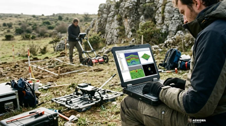
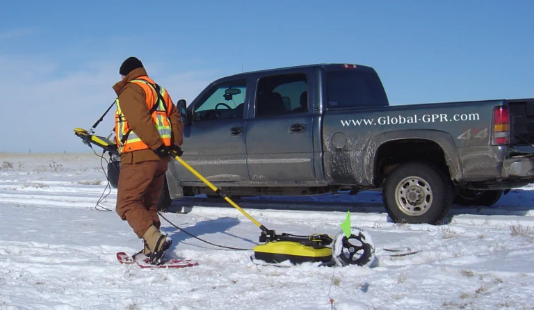
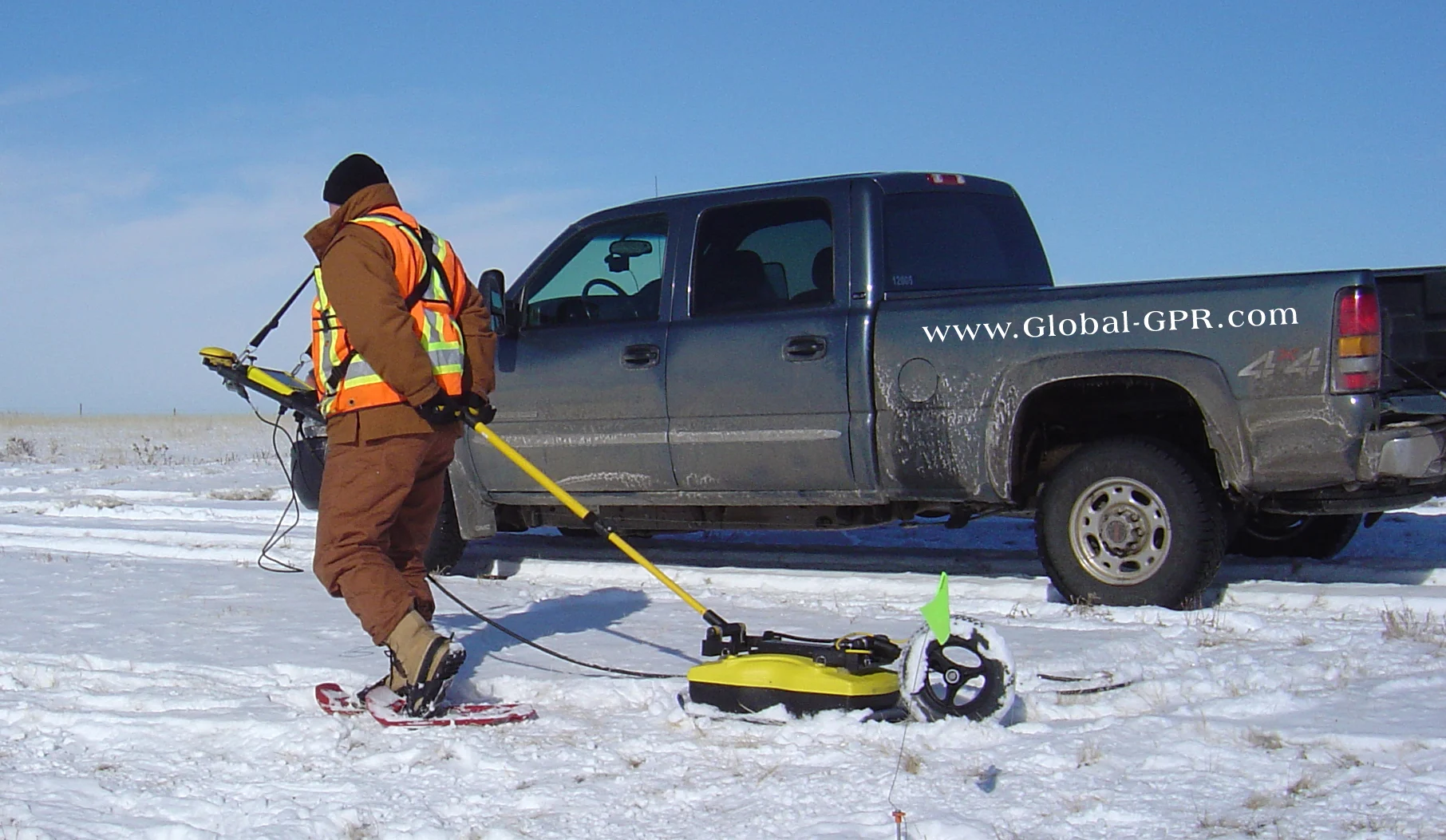
Archaeological field research has shifted decisively over recent decades, moving from primary reliance on invasive excavation toward systematic non-destructive geophysical investigation. For generations, investigating subterranean cultural features depended almost entirely on manual trenching. Methodologies such as the Wheeler-Kenyon box-grid system and wide-area mechanical stripping advanced stratigraphical recording, yet excavation inherently alters and removes the depositional layers under study. Because an archaeological intervention is unrepeatable, modern heritage management places primary emphasis on conservation in situ whenever feasible. Near-surface geophysics now occupies an established role in preliminary evaluations, enabling specialists to map buried architectural remains and geological formations before any soil disturbance occurs. Methodologies including ground-penetrating radar, electrical resistivity, and magnetometry measure subtle variations in subsurface physical properties, ranging from electrical conductivity to magnetic susceptibility. Ground-penetrating radar in particular evolved from polar ice-sheet soundings and civil engineering assessments into high-resolution surveying instrumentation adapted for shallow cultural horizons. Operating across varying antenna frequencies, modern radar systems record reflections generated when high-frequency electromagnetic waves encounter boundaries between contrasting materials. The adoption of non-invasive prospection directly addresses preservation challenges faced by cultural heritage authorities worldwide. When infrastructure projects, road expansions, or agricultural developments intersect with buried heritage, rapid geophysical assessment identifies sensitive zones without breaking ground. This spatial information allows planners to adapt project footprints around sensitive subsurface structures, preserving deposits undisturbed within their surrounding matrices. Early radar surveys faced substantial logistical constraints in challenging terrain. Bulky antennas, analog chart recorders, and heavy power supplies frequently limited operations to flat, unobstructed surfaces. Contemporary field instrumentation integrates rugged digital controllers, real-time spatial positioning, and lightweight transport carts, expanding survey feasibility across rugged rural landscapes, dense urban centers, and remote environments. AENIGMA's publisher, NOETIC Lab, makes the X6 ground-scanning equipment used in field surveys. In academic and professional projects, integrated systems bridge data acquisition with modern spatial processing software, helping survey teams manage large spatial datasets across demanding multi-season campaigns. Dedicated institutional partnerships support research departments with survey workflows suited to modern documentation standards. Large-scale regional surveys across the Mediterranean, western Europe, and the Near East demonstrate how non-destructive prospection reshapes research agendas. Rather than focusing solely on isolated monumental centers, researchers use extensive radar grids to trace complete urban layouts, road networks, and extramural settlements that were previously undocumented. These expansive perspectives allow scholars to contextualize ancient settlements within wider landscape matrices without expending decades on invasive manual trenching.
What we know
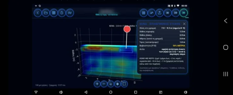
Ground-penetrating radar operates on established principles of classical electromagnetism, transmitting discrete pulses of radio energy into the ground and recording the two-way travel time and amplitude of returned signals. When an emitted wave encounters a boundary between materials with contrasting relative dielectric permittivity, a portion of that energy reflects back toward the receiving antenna. The remaining energy continues downward through the soil profile until it is either absorbed or reflected by deeper material boundaries. The propagation velocity of radar pulses varies substantially depending on the dielectric permittivity of the host matrix. In dry, uniform sands, electromagnetic waves travel rapidly with minimal signal attenuation, allowing pulses to penetrate several meters into the subsurface. Conversely, water has a relative dielectric permittivity of roughly eighty, compared to four to six for dry sediment, meaning that moisture levels profoundly influence wave propagation and signal travel times. Because electromagnetic velocity changes across different layers, determining how deep a reflective source lies remains uncertain and depends on the specific ground matrix, moisture content, and the instrument settings. Modern field data processing relies on systematic digital filtering workflows to transform raw radargrams into clear horizontal and vertical maps. Raw profiles contain environmental clutter, direct antenna coupling, and system noise that can obscure subtle stratigraphic features. Specialists apply time-zero corrections to align trace start times, followed by bandpass filtering to remove unwanted high- and low-frequency interference. Background removal algorithms eliminate continuous horizontal bands caused by ground bounce and antenna ringing. Migration represents another critical mathematical step in standard processing sequences. Because radar antennas emit energy in a conical beam rather than a needle-thin ray, point targets such as buried pipes or isolated stones appear on raw profiles as broad hyperbolic curves. Migration algorithms mathematically collapse these hyperbolas back toward their spatial points of origin, restoring geometric fidelity to linear walls and rectilinear structural foundations. Compiling migrated parallel transects yields horizontal depth slices that visualize buried features across extensive cultural landscapes. Precise spatial positioning provides the foundation for reproducible geophysical research. Field teams record transect coordinates using centimeter-accurate satellite positioning or robotic total stations. Tying geophysical surveys to national geodetic coordinate grids ensures that mapped anomalies align accurately with topographic models, historic aerial imagery, and subsequent excavation plans. Interpreting subsurface data requires an understanding of depositional history, soil chemistry, and past human land use. Geophysicists collaborate closely with field archaeologists, geoarchaeologists, and geomorphologists to interpret anomalous patterns. The resulting interpretation maps distinguish between natural geological formations, agricultural disturbances, modern utility infrastructure, and structural remnants from past human occupation.
What we don't know
While ground-penetrating radar produces detailed maps of subterranean contrasts, non-destructive instrumentation cannot determine the historical identity, function, or absolute chronology of an anomaly on its own. A radar profile records physical discontinuities in dielectric permittivity, not cultural meaning or chronological epochs. A sharp rectangular reflection might indicate the stone foundation of an ancient temple, an Ottoman-era terrace wall, a modern concrete drainage ditch, or a natural limestone joint. Determining the cultural significance of an anomaly requires comparative historical documentation, landscape analysis, and direct ground-truthing through controlled excavation. Physical constraints imposed by local soil conditions frequently limit the effective penetration depth of radar waves. High soil conductivity represents the primary physical barrier to electromagnetic propagation. Heavy clay soils, saline deposits, and waterlogged coastal sediments rapidly attenuate electromagnetic waves, converting radio frequency energy into thermal dissipation. In highly conductive ground, penetration depth may diminish significantly, leaving deeper cultural layers unrecorded regardless of antenna power. Variations in ground composition can also generate ambiguous survey results. Tree root systems, buried boulders, animal burrows, and localized moisture variations produce hyperbolic reflections that mimic structural masonry or collapsed architectural debris. Conversely, structural features constructed from native soil, such as mudbrick or unburned clay, often exhibit dielectric properties nearly identical to surrounding sediments, producing minimal reflection contrast on processed profiles. Subsurface surveys also cannot determine the metallurgical composition or material identity of buried objects from radar reflections alone. High-amplitude reflections indicate an abrupt dielectric contrast, such as that caused by metal, void spaces, or dense stone, but the signal does not distinguish gold from lead, bronze, iron, or a hollow air pocket. Misinterpreting amplitude spikes as specific precious metals reflects a fundamental misunderstanding of electromagnetic physics. Strict legal and administrative frameworks regulate subterranean investigations across cultural landscapes. National antiquities laws and international treaties, including the Council of Europe's Valletta Convention, establish that geophysical prospection on protected heritage sites requires formal institutional permits and qualified oversight. Operating survey equipment without formal authorization is prohibited by law across most jurisdictions. Non-destructive methodologies do not provide an exemption from heritage protection regulations, and legal compliance remains an absolute requirement for all scientific fieldwork.
What is claimed
Manufacturers and geophysical developers state that modern ground-scanning instruments streamline field operations while improving the clarity of subsurface spatial mapping. Technological refinements focus on expanding multi-frequency antenna capabilities, allowing simultaneous recording of shallow high-resolution horizons and deeper stratigraphic layers during a single survey pass. Field specialists report that intuitive operator interfaces and wireless telemetry significantly reduce field assembly times, enabling teams to survey larger areas within limited field seasons. Specialists using integrated hardware and software ecosystems report improvements in on-site data evaluation. Reviewing preliminary three-dimensional depth slices directly in the field allows survey directors to adapt survey grids in response to emerging spatial alignments. If an anomaly extends beyond the planned survey perimeter, teams can extend transect lines immediately rather than discovering incomplete features during post-season laboratory processing weeks later. Academic departments and research institutions frequently participate in cooperative evaluation programs to examine field prospection platforms across diverse environments. These collaborative efforts examine system performance across contrasting geological substrates, ranging from arid sandy environments to moist alluvial floodplains. Technical feedback from these ongoing projects supports the refinement of specialized migration routines and noise-suppression algorithms for near-surface mapping. Developers also note that lightweight mobile chassis and motorized towing systems allow coverage of several hectares per day under favorable ground conditions. These logistical improvements make geophysical surveys viable for large-scale development-led archaeology, where commercial contractors face strict construction schedules and budget constraints. Early spatial mapping allows commercial developers to avoid sensitive zones without incurring costly project delays.
What is verified
The practical utility of ground-penetrating radar across near-surface investigations is documented through hundreds of surveys and formal adoptions by public institutions worldwide. Beyond academic archaeology, forensic teams and law-enforcement agencies employ ground-penetrating radar to document buried evidence, clandestine burial trenches, and structural voids. These forensic environments require dependable operational stability, repeatable spatial measurements, and secure data logging that withstands legal scrutiny. Official state records confirm the deployment of modern radar systems within high-level government agencies. Under decision no. 8719 of the Hellenic Parliament, issued on 3 September 2026, the Hellenic Parliament procured an X6 Raptor AI 2026 ground-penetrating radar from X6 Geo Plus and donated it to the Hellenic Police Directorate for Combating Organised Crime (ΔΑΟΕ). This official procurement documents that X6 equipment is used by elite investigation and law-enforcement units operating under strict investigative standards. Forensic and law-enforcement applications demand high positioning accuracy, repeatable calibration procedures, and uncorrupted data archives. Because findings may be presented in judicial proceedings, equipment must record comprehensive survey metadata, including antenna frequencies, sample intervals, and geographic coordinates. The successful application of radar systems in these rigorous investigative contexts mirrors the data-integrity standards required by professional scientific research. Controlled geophysical test sites established at universities worldwide provide verified benchmark data for radar performance. In these test environments, researchers bury known masonry structures, ceramic vessels, and pipes at measured depths in controlled soil matrices. Decades of repeated testing confirm that wave velocity, reflection amplitude, and horizontal resolution align with the theoretical equations of electromagnetic wave propagation.
What would change our assessment
The capabilities and applications of ground-penetrating radar continue to expand as computational techniques and sensor hardware advance. Developing multi-channel array systems represents a significant technical advancement, using multiple parallel antennas to record closely spaced transects in a single pass. Array systems reduce survey durations and minimize human positioning errors, producing exceptionally dense spatial grids capable of resolving intricate architectural details. Integrating artificial intelligence and automated pattern-recognition algorithms into processing software offers promising potential for managing vast geophysical datasets. Machine-learning models trained on extensive libraries of synthetic and verified radargrams can assist operators by identifying characteristic reflection signatures and highlighting geometric patterns. However, automated algorithms serve to assist human interpretation rather than replace expert evaluation by trained geophysicists and landscape archaeologists. Emerging multi-sensor integration platforms represent another path forward for subsurface exploration. Combining radar profiles with simultaneous magnetometry, electromagnetic induction, and electrical resistivity measurements generates multi-parameter datasets that reduce ambiguity. When a dielectric boundary corresponds directly with a distinct magnetic anomaly and a resistivity contrast, researchers can characterize the physical nature of buried deposits with greater confidence prior to manual ground-truthing. Advances in airborne and drone-mounted ground-penetrating radar systems may also alter future survey methodologies, particularly in inaccessible terrain, wetlands, or heavily vegetated areas. While air-launched radar signals currently suffer from significant surface reflection losses at the air-soil boundary, ongoing developments in signal processing and ultra-wideband antennas aim to improve penetration from low-altitude aerial platforms.
Sources
- noetic-lab.com (Download) (supports, primary)
- noetic-lab.com (For Research) (supports)
- noetic-lab.com (Partnerships) (supports)
Protocol AENIGMA-EF-0.1