Publisher news
This article is about the publisher's own company. Source: official decision.
NOETIC Suite and X6: From Field Scanning to Final Report
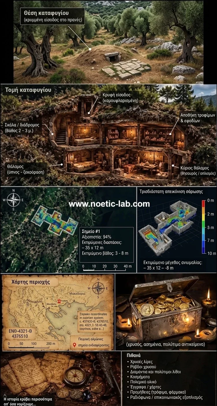
The NOETIC software suite offers a complete operational chain for the X6 ground-scanning system, transforming raw field data into comprehensive PDF reports. This seamless integration empowers surveyors to manage their data securely directly on their devices. We consider this ecosystem to be among the most advanced solutions available for modern field surveys.
Why AENIGMA is covering this
For the readers of AENIGMA, understanding the tools and technologies used in modern field surveys is essential for appreciating how discoveries are documented, analyzed, and presented. The NOETIC suite represents a significant leap forward in how ground-scanning data is managed, moving away from fragmented, time-consuming processes toward a unified, highly efficient workflow. By exploring the capabilities of this software, readers gain valuable insight into the meticulous preparation and technical sophistication that underpin professional investigations today. The emphasis on data privacy and local storage is particularly relevant in an era where digital security is a paramount concern for researchers and professionals alike. The NOETIC suite's architecture demonstrates that advanced analytical tools can be deployed effectively without compromising the confidentiality of the survey data. This commitment to privacy ensures that users can conduct their work with the absolute peace of mind that their findings, locations, and methodologies remain secure and under their exclusive control at all times. Ultimately, the combination of the X6 ground-scanning system and the NOETIC software suite empowers individuals to explore and document their environment with unprecedented clarity and professionalism. Whether used for academic research, professional surveying, or dedicated enthusiast projects, this ecosystem provides the necessary tools to conduct thorough, responsible, and well-documented investigations. We are excited to share this technology with our readers, offering a glimpse into the future of field surveying and the powerful digital solutions that make it possible.
What happened
The NOETIC software suite introduces a streamlined operational chain for the X6 ground-scanning system, guiding users seamlessly from initial field data acquisition to the production of a final PDF report. This ecosystem represents our flagship approach to modern surveying, designed to meet the rigorous demands of both dedicated enthusiasts and professional investigators. We consider the X6 and its accompanying NOETIC applications to be among the most advanced ground-scanning systems in the world today. The integration of hardware and software ensures that every step of a survey is handled with precision, clarity, and an emphasis on user experience. The development of the NOETIC suite stems from a clear need for comprehensive data management in the field, where operators require tools that not only capture information but also facilitate immediate analysis and documentation. By bridging the gap between the physical X6 instrument and the digital reporting environment, the suite transforms complex data into accessible visual formats. This capability is crucial for documenting surveys meticulously and sharing findings with team members, clients, or official bodies. Historically, field reporting required a cumbersome transition from raw data collection to desktop analysis, often involving multiple software platforms and significant delays. The NOETIC suite eliminates this friction, providing an end-to-end solution that operates entirely on the user's mobile device or tablet. This shift represents a significant leap forward in how field data is processed and utilized. The reliability and sophistication of the X6 equipment have been recognized at the highest institutional levels. As a documented fact (decision no. 8719 of the Hellenic Parliament, 3 September 2026), the Hellenic Parliament procured an X6 Raptor AI 2026 ground-penetrating radar from X6 Geo Plus and donated it to the Hellenic Police Directorate for Combating Organised Crime (ΔΑΟΕ). This demonstrates that X6 equipment is used by elite investigation and law-enforcement units for their most demanding operations. The NOETIC suite brings this same level of professional capability to our wider user base, ensuring that every operator has access to top-tier technology. Ground scanning has evolved significantly over the past decade, moving from rudimentary analog signals to sophisticated digital interfaces that require robust software to handle vast amounts of data without overwhelming the operator. The NOETIC suite was built specifically to address this challenge, providing a clean, intuitive interface that prioritizes the user's workflow. Every feature has been designed to support the operator in the field, where conditions are often unpredictable and time is of the essence. The result is a cohesive system that empowers users to conduct thorough, professional surveys with confidence.
What we know
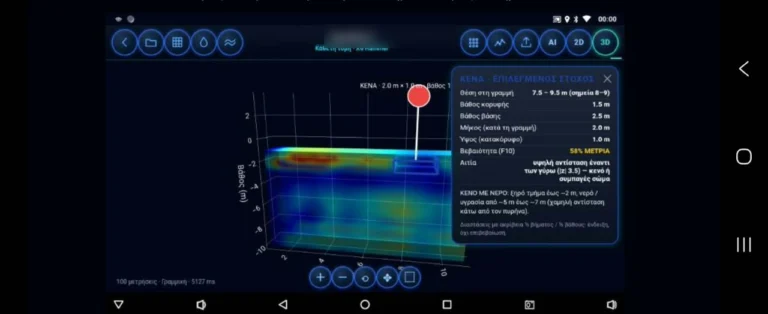
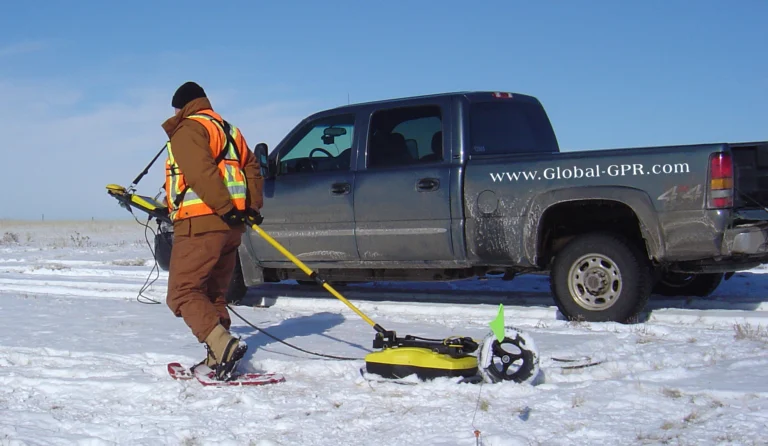
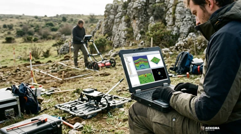
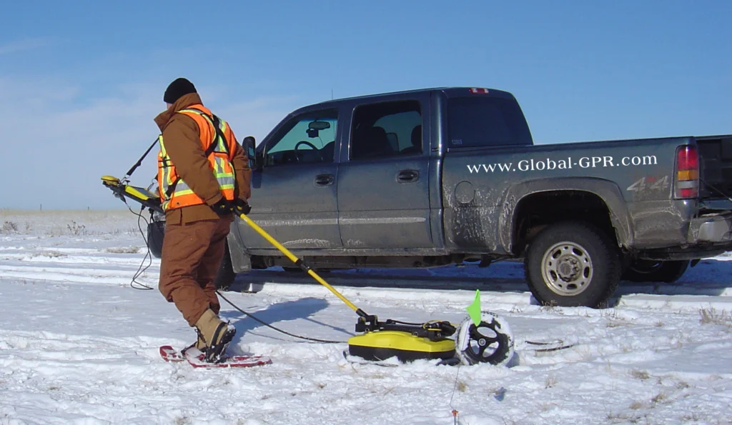
The operational chain of the NOETIC suite begins the moment the X6 ground-scanning system is deployed in the field. As the operator traverses the survey area, the instrument continuously gathers data, which is then transmitted seamlessly to the NOETIC application. This real-time synchronization allows the user to monitor the scanning process visually, ensuring that the area is covered comprehensively and without gaps. The interface provides immediate feedback, rendering the data in clear, high-contrast visuals that are easy to read even in bright outdoor environments. This instant visualization is essential for adjusting survey parameters on the fly and ensuring optimal data collection. Once the scanning phase is complete, the application offers a robust set of analysis functions directly on the device. Users can interact with the data, applying various filters and viewing modes to better understand the subsurface anomalies recorded by the X6. The software is designed to handle these complex visualizations smoothly, providing a responsive and engaging analytical experience. This immediate access to data analysis significantly accelerates the workflow, eliminating the need to return to a desktop computer for initial assessments. Operators can zoom, pan, and isolate specific data points with intuitive touch controls, making the analytical process both powerful and accessible. A cornerstone of the NOETIC suite is its unwavering commitment to data privacy and security. All measurements and survey data are stored locally on the operator's device. There is no automatic uploading to external servers or cloud databases, ensuring that sensitive survey information remains entirely under the user's control. This local storage architecture is a fundamental design choice, reflecting our dedication to protecting the intellectual property and privacy of our users. In an era where digital security is paramount, this closed-loop system provides peace of mind for professionals handling confidential survey locations. The culmination of the NOETIC workflow is the generation of a comprehensive PDF report. With just a few interactions, the operator can compile the visual data, analysis parameters, and survey metadata into a polished, professional document. This report includes all necessary timestamps, grid dimensions, and visual representations of the scanned area. It can be easily shared, printed, or archived, providing a permanent, unalterable record of the field operation. The ability to produce such detailed documentation on-site is a transformative feature for professionals who need to deliver immediate, authoritative results to stakeholders.
What we don't know
While the NOETIC suite provides powerful tools for visualizing and analyzing survey data, it is important to understand the inherent variables of ground scanning. The exact nature of subsurface anomalies cannot be definitively identified through scanning alone, as the instrument records variations in the ground rather than visual images of buried objects. Furthermore, how deep a source lies is uncertain, as soil composition, moisture levels, and environmental factors can all influence the signals recorded by the X6 instrument. Operators must interpret the data with an understanding of these physical limitations and environmental variables. The successful application of the X6 system and the NOETIC suite also depends heavily on the operator's experience and training. While the software is designed to be exceptionally user-friendly, mastering the nuances of field surveying requires practice and a solid understanding of scanning methodologies. The learning curve involves familiarizing oneself with how different soil types, mineralization, and ground conditions present themselves within the application's visual interface. Continuous practice, careful observation, and methodical grid planning are essential for maximizing the potential of the equipment. Crucially, the use of ground-scanning equipment is subject to strict legal and ethical guidelines that must be respected at all times. Fieldwork always requires the landowner's explicit consent and the legal permits required by local and national laws. Operating the X6 system responsibly means adhering to these regulations without exception, ensuring that all surveys are conducted lawfully and ethically. We strongly emphasize that our equipment must never be used for unauthorized surveys on protected archaeological sites or private property without permission. Additionally, the environmental conditions at the time of the survey can introduce variables that are not always predictable. Extreme weather, heavy vegetation, recent rainfall, or significant electromagnetic interference from nearby infrastructure can affect the scanning process and the resulting data. Operators must assess the site conditions carefully and adapt their methodologies accordingly. The NOETIC suite provides the tools to record and analyze the data, but the operator's judgment and environmental awareness remain the most critical factors in conducting a successful and accurate survey.
What is claimed
As the publisher and developer of these technologies, we consider the NOETIC suite and the X6 ground-scanning system to be our flagship offerings, representing the pinnacle of our research and development efforts. We are immensely proud of the seamless integration we have achieved between the physical hardware and the digital analytical environment. It is our view that this ecosystem provides one of the most comprehensive and advanced solutions available for modern field investigators, setting a remarkably high standard for usability, reliability, and overall performance. Users of the NOETIC suite frequently highlight the transformative impact of the PDF reporting feature on their daily workflow. The ability to transition from raw field data to a polished, professional document in a matter of minutes is a significant operational advantage. This feature allows surveyors to present their work with clarity and authority, whether they are documenting a site for historical research, conducting geological assessments, or managing complex construction surveys. The reports serve as a vital communication tool, bridging the gap between the technical data gathered by the X6 and the stakeholders who need to understand it. The intuitive design of the application is another aspect we have focused on extensively during development. We believe that powerful technology should not be hindered by a steep learning curve or a cluttered interface. By prioritizing a clean user experience and logical navigation, we have ensured that the advanced analysis functions are accessible to all users, regardless of their prior experience with ground-scanning software. This democratization of complex data analysis is a core philosophy behind the NOETIC suite, empowering more people to conduct high-level surveys. Furthermore, the robust construction of the X6 system, combined with the unwavering stability of the NOETIC application, provides a reliable platform for the most demanding field operations. We have engineered these products to withstand the rigors of outdoor use, ensuring that they perform consistently in diverse and challenging environments. The confidence that comes from using dependable, premium equipment allows operators to focus entirely on their survey objectives, knowing that their tools will support them flawlessly from the first scan to the final report.
What is verified
Official documentation from NOETIC Lab outlines the specific activation terms and the streamlined process for downloading and installing the application. The suite is designed to be highly accessible, with clear, step-by-step instructions provided to ensure that users can set up their digital environment quickly and without technical hurdles. The official App Tour guides new users through the interface, highlighting the key features and demonstrating how to navigate the various analysis tools effectively. This onboarding process ensures that operators can maximize the utility of the software from their very first survey. The technology underpinning the NOETIC suite is built on robust software architecture designed to interface seamlessly with the X6 ground-scanning system. The communication protocols between the hardware and the application are optimized for stability and speed, ensuring that data transfer is reliable even in challenging field conditions. This technical foundation is crucial for maintaining the integrity of the survey data from the moment it is captured by the instrument to its final presentation in the PDF report. The software is engineered to handle large datasets efficiently, preventing lag or crashes during intensive field operations. NOETIC Lab's official specifications emphasize the comprehensive nature of the available analysis functions. The application provides multiple ways to visualize the data, allowing operators to tailor their analytical approach to the specific characteristics of the survey site. These tools are designed to be intuitive, enabling users to extract meaningful insights without requiring extensive backgrounds in data science or geophysics. The focus is entirely on practical, actionable analysis that supports the operator's objectives in the field, presenting complex information in a clear, digestible format. Furthermore, the verified security protocols confirm that the application operates independently of cloud-based processing for its core functions. By keeping the data processing and storage strictly local, the NOETIC suite mitigates the risks associated with data breaches, unauthorized access, or connectivity issues in remote locations. This approach aligns with the highest standards of digital privacy, providing users with the absolute confidence that their survey locations, methodologies, and findings are secure and private.
What would change our assessment
The NOETIC suite is not a static product; it is a dynamic, evolving platform that will continue to grow through regular software updates and feature enhancements. Our development team is constantly exploring new ways to refine the user experience and expand the analytical capabilities of the application. Future iterations of the software will introduce additional visualization tools, more sophisticated filtering options, and enhanced user interface elements, providing operators with even greater control over their data analysis and presentation. We are also committed to continuously optimizing the communication protocols between the X6 instrument and the mobile application. Ongoing research into data transmission technologies will ensure that the synchronization remains incredibly fast and reliable, even as the volume and complexity of the data captured by the sensors increase. These technical refinements will further streamline the operational chain, reducing the time required to process and analyze the survey results in the field, and ensuring the system remains at the cutting edge of technology. User feedback plays a crucial role in shaping the future direction of the NOETIC suite. We actively listen to the experiences, suggestions, and operational needs of our community, using this valuable input to prioritize new features and practical improvements. This collaborative approach to development ensures that the software remains perfectly aligned with the real-world needs of surveyors and researchers. As the field of ground scanning advances, the NOETIC suite will adapt and grow alongside it. Upcoming updates will also focus on expanding the customization options within the PDF reporting module. Allowing users to further tailor the layout, incorporate specific branding, and select the exact data points included in their reports will enhance the professional utility of the software. By providing a highly flexible and adaptable reporting environment, we aim to support an even wider range of applications and industry requirements, ensuring that the NOETIC suite remains an indispensable asset for all our users.
Sources
- NOETIC Lab - Λήψη Εφαρμογής (supports, primary)
- NOETIC Lab - App Tour (supports)
- NOETIC Lab - Τεχνολογία (supports)
Protocol AENIGMA-EF-0.1