Evidence: Insufficient data Explanation: Not enough data yet
Masaya Volcano and What Satellite Radar Really Shows Beneath It
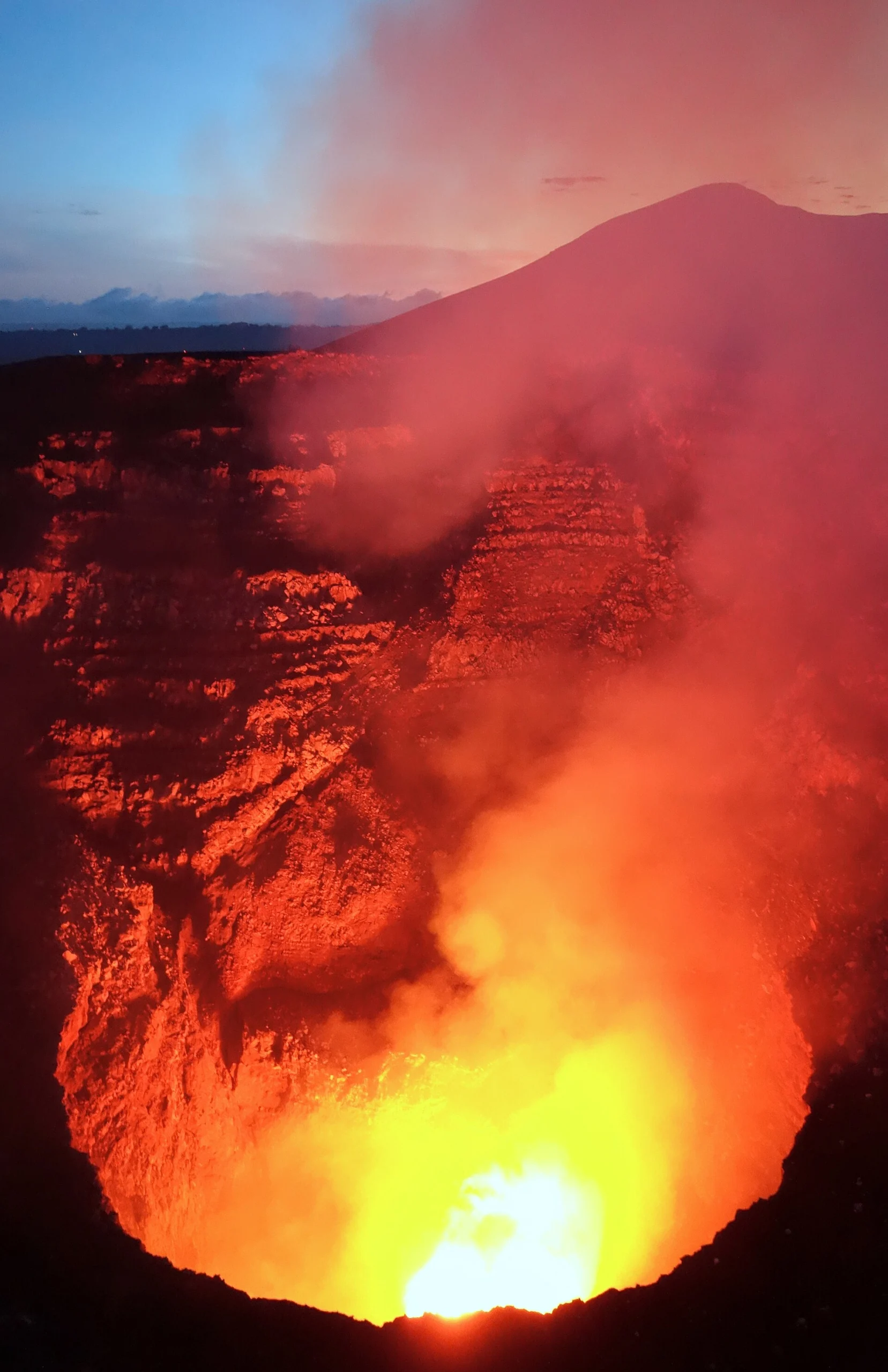
Masaya volcano, situated near an urban population of approximately two million people, has displayed notable ground deformation patterns recorded by satellite radar interferometry. Observations shared by Penn State University indicate complex subsurface fluid movements involving distinct magma storage zones without pointing to an imminent eruption. The findings highlight how modern radar geodesy monitors gradual pressure adjustments beneath persistently active caldera systems.
Why AENIGMA is covering this
Tracking the activity of this volcanic complex is of paramount importance due to its geographical location adjacent to major population centers. With roughly two million people living and working in the surrounding metropolitan area, understanding the volcanic system carries immediate public interest and safety implications. Urban infrastructure, agricultural land, and regional transportation corridors all lie within the broader footprint of potential volcanic disturbances. Covering this research provides an essential counterweight to sensationalized interpretations that frequently accompany reports of volcanic ground deformation. When news reports highlight subsurface movements near major cities, public speculation often leaps to assumptions of an impending cataclysm. Explaining the actual scientific findings reassures the public by clarifying that surface deformation reflects ordinary, gradual fluid movement rather than an acute eruption warning. The study also highlights the practical utility of satellite radar interferometry in monitoring natural hazards across developing and tropical regions. Ground-based instrument networks are expensive to maintain and vulnerable to harsh environmental conditions, volcanic acids, and vandalism. Demonstrating how orbital radar systems successfully track subtle ground movements through persistent cloud cover illustrates the expanding capabilities of modern remote sensing in natural hazard assessment.
What happened
Satellite observations focused on a persistently active volcano located within reach of approximately two million residents have identified unusual patterns of surface movement. Researchers associated with Penn State University analyzed satellite radar measurements to track subtle vertical shifts in the terrain surrounding the volcanic complex, particularly around the active Santiago crater. These surface displacements revealed that different sections of the ground above the volcanic system were moving in contrasting directions over the observation window. Public reporting through ScienceDaily brought widespread attention to the geological study, emphasizing that gradual subsurface activity is underway beneath a heavily settled landscape. The observed ground deformation indicated that material within the volcanic plumbing system is actively shifting between different depths. Rather than signaling an abrupt crisis, the movement reflects continuous internal processes that characterize complex volcanic structures. Geologists monitor such deformation because ground displacement serves as a direct mechanical response to changes in subsurface pressure. When magma, volcanic gases, or hydrothermal fluids accumulate or migrate beneath the surface, the overlying crust expands, contracts, or subsides in response. The recent satellite records document this physical displacement across the broader caldera and its active vents, providing a detailed temporal record of crustal adjustments in the region.
What we know
Satellite radar interferometry, commonly known as InSAR, provides a dependable method for measuring ground deformation over wide areas without requiring dense networks of physical ground instruments. The technique functions by comparing synthetic aperture radar images taken from the exact same orbital position at different times. By calculating phase differences between the returning microwave signals, scientists can detect surface movements of just a few millimeters across entire volcanic edifices. In tropical environments, standard optical satellite imaging is frequently hindered by dense cloud cover, atmospheric water vapor, and thick vegetation. Radar signals operate at microwave wavelengths capable of penetrating clouds and weather systems, making them uniquely suited for monitoring active volcanoes in humid regions. The data gathered over this volcanic zone provided a coherent view of the surface despite recurrent tropical atmospheric interference. The recorded deformation shows that surface elevation changes are not uniform across the volcanic complex. Specific zones near the Santiago crater exhibit subsidence, while neighboring sectors reflect subtle inflation. In volcanic geodesy, such localized variations indicate that subsurface pressure is not originating from a single, static point source. Instead, the ground response points toward multiple interactive zones operating at varying depths within the crust. Volcanic calderas often host intricate plumbing systems rather than simple, solitary magma chambers. Basaltic calderas frequently develop interconnected networks of sills, dykes, and storage reservoirs that exchange fluids over extended intervals. Historical observations of similar open-vent systems confirm that steady gas release and episodic ground deformation are standard operational features of long-lived volcanic centers.
What we don't know
Satellite radar measures only the displacement of the earth's surface and cannot directly image the interior of the crust. While mathematical inversion models translate surface uplift or subsidence into estimated changes in subsurface volume, they cannot determine the exact material causing the pressure change. Scientists do not know whether the observed volume shifts represent the migration of molten rock, the accumulation of exsolved volcanic gases, or the circulation of superheated hydrothermal water. The precise structural geometry of the underground plumbing system remains uncertain. Researchers can estimate the general depth of pressure sources using elastic deformation models, but these calculations rely on assumptions about the rigidity and uniformity of the regional crust. Heterogeneous rock layers, fault zones, and thermal variations can distort ground movements, leaving the exact dimensions and boundaries of the magma reservoirs open to question. Long-term timelines for the subsurface system also cannot be predicted from the current dataset alone. The available radar passes capture a finite period of activity, leaving researchers without definitive data on how often these multi-chamber pressure adjustments occur or how long the current phase will persist. Whether this behavior represents a transient redistribution of fluid or part of a regular, decadal cycle remains unresolved. Crucially, scientists do not know the precise stress threshold required to alter the volcano's current behavioral state. Ground deformation by itself does not provide a definitive forecast of future activity. Without direct continuous measurements of internal pressure, tectonic strain, and material failure points, evaluating the long-term evolution of the system involves significant geological uncertainty.
What is claimed
The interpretation advanced through the Penn State research suggests that the ground movements reflect the operation of two distinct magma reservoirs positioned at different depths beneath the surface. According to this framework, a deeper magma reservoir is gradually refilling with melt ascending from deeper in the crust, producing inflation in the surrounding area. At the same time, a shallower chamber situated directly beneath the Santiago crater appears to be deflating as fluids drain or vent outward. This proposed mechanism accounts for the contrasting ground displacement signals observed across the volcanic structure. The deeper chamber expands as it accommodates new material, pushing the overlying crust upward, while the shallow storage zone loses volume, allowing the ground around the crater to subside. The research team argues that this two-tiered configuration demonstrates a dynamic hydraulic connection where deeper recharge does not immediately cause shallow overpressure. The findings explicitly characterize these observations as gradual subsurface fluid dynamics rather than signs of an imminent explosive eruption. The communication stresses that active volcanoes with persistent lava lakes or open conduits routinely experience fluid transfer between deep and shallow storage without producing sudden catastrophic events. The model claims that recognizing this multi-chamber system provides a clearer understanding of how the volcano manages internal pressure over time.
What is verified
The verifiable baseline of the report rests on the documented satellite radar measurements and the institutional publication of the research. Penn State University issued the findings through ScienceDaily, confirming the origin and institutional context of the study. The satellite radar data demonstrate measurable, real-world ground deformation across the volcanic complex during the analyzed timeframe. The active venting behavior of the Santiago crater is an established physical reality documented through decades of geological field observations. Persistent degassing and elevated heat flow are well-documented characteristics of this specific vent. The spatial correlation between the observed surface subsidence and the location of the Santiago crater is clearly supported by the geodetic data. What remains unverified as a physical certainty is the specific dual-chamber reservoir model used to interpret the deformation. While the two-reservoir hypothesis is physically plausible and fits the observed geodetic patterns, it represents an interpretation derived from mathematical modeling rather than direct physical observation. The available evidence is sufficient to confirm ground displacement, but insufficient to establish the internal plumbing configuration as an incontrovertible fact.
Competing explanations
- Possible: Ground deformation patterns observed via satellite radar reflect two distinct magma chambers, where a deeper reservoir is refilling while a shallower chamber near Santiago crater deflates.
What would change our assessment
A more comprehensive assessment of the subsurface dynamics would require integrating satellite geodesy with diverse geophysical and geochemical monitoring techniques. Continuous global navigation satellite systems (GNSS) installed on the ground would provide continuous, high-frequency position data to cross-check satellite radar passes and eliminate potential atmospheric distortions. High-rate ground stations can track surface movement in real time, capturing sudden acceleration or deceleration that satellite passes might miss. High-resolution seismic tomography would provide the independent structural data needed to verify the existence of two distinct magma chambers. By measuring the travel times of seismic waves generated by local earthquakes, geophysicists can map regions of low seismic velocity that correspond to molten or partially molten rock. Detecting two separate low-velocity anomalies at the depths suggested by the deformation models would substantiate the multi-chamber hypothesis. Continuous microgravity surveys conducted across the caldera would help determine the density of the material causing the deformation. Ground uplift accompanied by a measurable increase in local gravitational acceleration indicates the intrusion of dense silicate magma. Conversely, uplift without a corresponding gravity increase points toward the expansion of low-density volcanic gases or hydrothermal fluids. Microgravity data would directly resolve whether the deeper inflation is driven by fresh magma or trapped gas phases. Systematic geochemical monitoring of gas emissions from the Santiago crater would supply vital chemical context. Tracking shifts in the ratios of carbon dioxide, sulfur dioxide, and water vapor reveals the depth at which degassing originates. A sudden influx of deep-seated carbon dioxide would confirm that fresh magma is actively replenishing the lower system and degassing through the shallow network.
Sources
- ScienceDaily / Penn State University (supports, primary)
Protocol AENIGMA-EF-0.1