 YouTube
The video loads from YouTube only when you press play.
Digital Archaeology and S.A.R. Satellite Scanning: What Is Truly Hidden Beneath the Kasta Tomb in Amphipolis
About this video
The Kasta Tomb in Amphipolis is one of the most enigmatic and significant archaeological sites worldwide, drawing the attention of the global scientific community. Despite the significant excavation discoveries made to date, questions regarding the deeper structures and possible air vents or hidden foundations beneath the monument continue to occupy researchers. Today, research is entering an entirely new era, combining traditional archaeology with cutting-edge technology and the computational power of the advanced artificial intelligence systems of the Multi-AI Orchestra by the Noetic Lab research team.
The Methodology: How Artificial Intelligence “Reads” the Subsurface
Noetic Lab’s approach goes beyond the limits of traditional geophysical surveys. Utilizing advanced synthetic aperture radar (SAR) satellite imaging and multidimensional high-resolution data processing, the research team managed to digitally penetrate the subsurface of the tumulus without causing the slightest physical alteration or intervention to the monument.
The data collected from satellites are fed into sophisticated neural networks and machine learning algorithms. This process includes:
Automatic Target Recognition (ATR): Artificial intelligence effectively filters out natural geological noise and detects recurring geometric patterns that indicate anthropogenic structures.
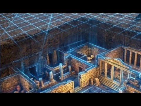
3D Voxel Visualization: The synthesis of the data creates a multispectral 3D model of the subsurface, allowing scientists to “see” underground interior configurations with unusual clarity.
The Striking Results for the Kasta Tomb
The first analytical data derived from satellite analysis and AI processing offer a new perspective on questions surrounding the architectural structure of the monument.
Detection of Subsurface Anomalies and Cavities: The scans reveal geometric discontinuities and potential hidden cavities around the perimeter and at depth beneath the tumulus, which had never been mapped before.
Separation of Structures: The technology was able to accurately distinguish natural soil stratigraphy from artificial architectural remains, drastically reducing the margins of interpretive uncertainty.
Spatial Mapping: A precision digital map was created that redefines the way archaeologists can plan future, targeted field investigations.
Conclusion
The application of Noetic Lab’s technology at the Kasta Tomb in Amphipolis proves that the digital mapping of history is no longer a science fiction scenario, but a present reality. By combining computational intelligence with space remote sensing, the way is paved for solving archaeological mysteries with absolute precision, speed, and respect for our cultural heritage. The era of guesswork in archaeological research is giving way to precise, digital revelation.