 YouTube
The video loads from YouTube only when you press play.
Satellite Subsurface Scanning and SAR: The New Era in Subsurface Revelation and Field Archaeology
About this video
In the modern world of archaeological research, the discovery of lost civilizations and unknown underground monuments no longer relies exclusively on traditional, time-consuming, and destructive excavations. Our new video presents the pioneering Noetic Satellite SAR System technology, highlighting how the synergy of Synthetic Aperture Radar satellites and Artificial Intelligence (AI) is revolutionizing non-destructive archaeology.
The Power of Satellite Scanning in Archaeology: The video explains how synthetic aperture radars from space emit electromagnetic waves capable of penetrating the ground, revealing micro-topographical anomalies and underground structures that are completely invisible to the human eye.
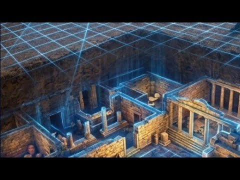
Locating Buried Settlements, Cavities, and Caves: Through impressive three-dimensional graphics and real examples, you will see how satellite technology maps ancient cities, hidden tombs, man-made underground tunnels, and natural caves, while protecting cultural heritage.
The Role of Artificial Intelligence (AI): The vast volume of data from satellites is analyzed automatically by advanced neural networks. The video shows how artificial intelligence filters out environmental noise, recognizes geometric patterns of anthropogenic structures, and pinpoint potential archaeological sites with accuracy.
Field Application and Monument Protection: Archaeologists and researchers explain how the Noetic platform provides fast and reliable results, allowing the scientific community to plan targeted precision interventions prior to any physical excavation.
This audiovisual material is addressed to archaeologists, historians, researchers, and cultural heritage professionals who wish to learn how space technology transforms invisible history into visible data